Why In News?
The Indian Space Research Organisation (ISRO) launched the NVS-03 navigation satellite aboard a GSLV-F18 (GSLV Mk II) rocket from the Satish Dhawan Space Centre in Sriharikota to restore 3D positioning services for NavIC.
What Is The NavIC Navigation System?
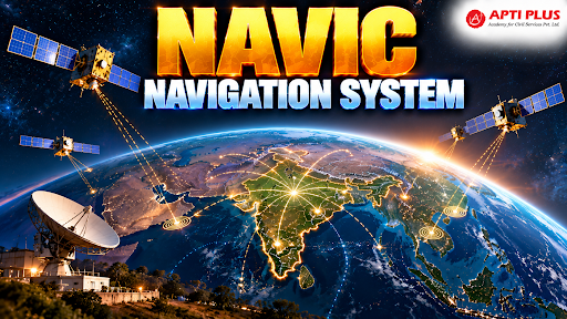
NavIC (Navigation with Indian Constellation), designated as the Indian Regional Navigation Satellite System (IRNSS), is an autonomous regional satellite navigation network operational since 2018.
-
Strategic self-reliance in satellite navigation became a national priority following the 1999 Kargil War, when foreign denial of GPS data restricted tactical defense operations in high-altitude conflict zones.
The space segment architecture consists of 7 satellites operating in high Earth orbits at an altitude of approximately 36,000 km, comprising 3 satellites in Geostationary Orbit (GEO), alongside 4 satellites in inclined Geosynchronous Orbit (GSO) at an inclination of 29°.
NavIC delivers location coverage across a Primary Service Area encompassing India and an extended boundary up to 1,500 km (bounded by 5°S to 50°N latitude and 55°E to 110°E longitude), alongside an Extended Service Area spanning 30°S to 50°N latitude and 30°E to 130°E longitude.
The system broadcasts two service tiers: the open Standard Positioning Service (SPS) offering civilian accuracy of 5 to 10 metres over the Indian landmass, and the encrypted Restricted Service (RS) dedicated to military defense and strategic applications.
By early 2026, severe satellite attrition reduced the active constellation to just 3 satellites (IRNSS-1B, IRNSS-1I, and NVS-01), falling below the mandatory 4-satellite threshold needed for independent 3D location positioning.
What is NVS-03?
NVS-03 is the third second-generation navigation satellite in the NavIC (Navigation with Indian Constellation) series developed by the Indian Space Research Organisation (ISRO).
-
Official Name: Indian Regional Navigation Satellite System (IRNSS).
-
Scope: It is a regional—not global—satellite navigation system designed to provide accurate Position, Navigation, and Timing (PNT) services.
-
Coverage Area: Encompasses India plus an extended area up to 1,500 km beyond its borders (and a broader regional rectangle).
-
Constellation Design: A fully operational system requires 7 satellites (3 in Geostationary Orbit/GEO and 4 in Inclined Geosynchronous Orbit/GSO).
-
Service Tiers:
-
Standard Positioning Service (SPS): Open to civilian users.
-
Restricted Service (RS): Encrypted service restricted to authorized military and strategic users.
Key Highlights of NVS-03
-
Role in Constellation: It is the 3rd second-generation satellite (and 12th overall in the IRNSS/NavIC lineage), built on the I-2K bus with a mass of 2,232 kg and a 12-year design life.
-
Restoring Minimum Capability: Due to satellite attrition and the failure of older atomic clocks, operational NavIC satellites dropped below the functional threshold.
-
Successfully deploying NVS-03 raises the active count to four, which is the minimum requirement for 3D standalone positioning (latitude, longitude, altitude, and clock error resolution).
-
Indigenous Rubidium Atomic Clock: Features a homegrown atomic clock developed by the Space Applications Centre (SAC) in Ahmedabad, fixing past vulnerabilities linked to imported clock failures.
-
Civilian L1-Band Support: Unlike older NavIC satellites that primarily used L5 and S bands, NVS-03 adds the civilian L1-band signal, enabling direct compatibility with everyday commercial devices like smartphones, smartwatches, and fitness trackers.
Source: INDIANEXPRESS
|
PRACTICE QUESTION Q. Consider the following pairs of Satellite Navigation Systems and their operating authority/country: 1. GLONASS : Russian Federation 2. Beidou : Japan 3. Galileo : European Union 4. QZSS : People's Republic of China How many of the above pairs are correctly matched? 1. GLONASS : Russian Federation — Correct
2. Beidou : Japan — Incorrect
3. Galileo : European Union — Correct
4. QZSS : People's Republic of China — Incorrect
|