Why In News?
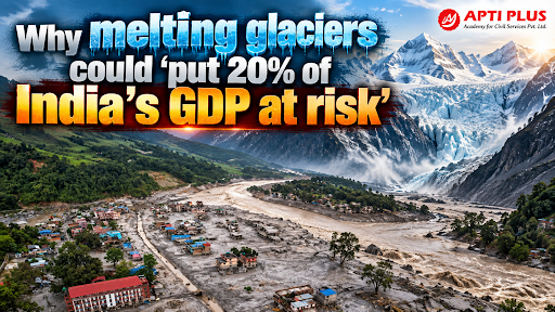
The Systemiq-led "A Resilient Himalaya" Report warns that accelerating Himalayan glacier retreat threatens water systems supporting 21.5% of India's GDP.
Current State Of Himalayan Glacier Retreat
Macroeconomic Vulnerability: 21.5% of India's FY24 GDP (₹64.8 lakh crore) directly, indirectly, or through induced supply-chain linkages relies on water originating from the Himalayas.
-
Three-Layer Valuation: This macroeconomic linkage is calculated across three distinct tiers: Direct GSDP of mountain states (5% share), Indirect value in downstream agriculture, manufacturing, and hydropower, and Induced value via supply-chain and wage-spending effects across non-mountain states.
Imminent Peak Water Tipping Point: River basins across the Hindu Kush Himalaya (HKH) are projected to reach Peak Water around 2050, after which glacier meltwater discharge will permanently decline as total ice volume shrinks by up to 80% by 2100 under high-emission scenarios.
Disaster Hotspot Cycle: The Himalayas account for 18% of India's land area but suffer 35% of all national natural disasters, creating an unsustainable cycle of infrastructure destruction, sovereign debt pressure, and diverted adaptation capital.
Accelerated Mass Loss: Glaciers in the Hindu Kush Himalaya (HKHK) are losing ice mass 65% faster in 2011–2020 compared to the preceding decade, retreating at a mean rate of 14.9 ± 15.1 meters per annum across the Indus, Ganga, and Brahmaputra basins.
Historical Shrinkage: Over the past 400 to 700 years since the Little Ice Age, Himalayan glaciers have lost approximately 40% of their total area, shrinking from 28,000 km² to 19,600 km².
Why Are Himalayan Glaciers Important For India's Ecological And Economic Security?
Freshwater Storage: The Himalaya, Karakoram, and Hindu Kush (HKHK) mountain ranges contain over 55,000 glaciers holding 163 km³ of ice, representing the largest freshwater reserve outside the polar regions. (Source: World Bank)
Major River Systems: Glaciers feed the Indus, Ganga, and Brahmaputra river systems, supplying perennial water to 240 million mountain inhabitants and 1.65 billion downstream inhabitants across South Asia. (Source: ICIMOD)
Agriculture and Irrigation: Glacier-fed rivers support wheat and rice cultivation across the Indo-Gangetic Plains, sustaining 60% of India's cultivated area and ensuring food security for 600 million people.
Hydropower Generation: Headwater discharge supports hydropower potential in northern and northeastern India, providing peak-load renewable energy.
Drinking Water Security: Himalayan runoff recharges alluvial aquifers across northern India and directly provides municipal water supplies for major urban centers including Delhi, Kanpur, and Kolkata.
How Does Rapid Glacier Melt Affect India's Hydrology And Disaster Landscape?
Short-term Increase in Runoff: Accelerated atmospheric warming causes temporary surges in summer streamflow, increasing river discharge in the Upper Indus Basin, Upper Ganga Basin, and Brahmaputra System.
Long-term Water Stress: As glaciers retreat past Peak Water, annual river discharge will plummet, substituting seasonal ice melt with erratic rainfall and exacerbating severe lean-season drought across the Indo-Gangetic Plains.
Glacial Lake Outburst Floods (GLOFs): Rapid ice retreat creates unstable moraine-dammed lakes; the Central Water Commission (CWC) currently monitors 2,485 glacial lakes larger than 10 hectares, with 56 lakes classified as very high risk.
Flood and Landslide Risks: Heavy melt coupled with extreme monsoonal downpours destabilizes high-altitude slope permafrost, triggering severe flash floods, debris flows, and river channel siltation.
Water Supply Disruption: Unpredictable river regimes disrupt municipal intake plants, compromise canal headworks, and accelerate reservoir sedimentation behind major multi-purpose dams like Tehri and Bhakra.
What Are The Major Causes And Drivers Of Accelerated Himalayan Glacier Retreat?
Global Warming & Human-Induced Climate Change: Global greenhouse gas emissions have driven average warming of 1.1°C above pre-industrial levels, accelerating global cryosphere decay (Source: IPCC)
Rising Himalayan Temperatures: Temperatures across the North-Western Himalayas have risen by 1.6°C over the past century, far exceeding the global surface warming average.
Changing Rainfall Patterns: Shift from winter snowfall to monsoon liquid rainfall at high elevations reduces seasonal snowpack accumulation, accelerating glacier mass loss rates up to 20.2 m/a in the Brahmaputra Basin. (Source: PIB)
Black Carbon Deposition & Snow Darkening Effect: Atmospheric soot particles from incomplete combustion settle on high-altitude snowpack, reducing surface albedo.
Industrial & Sectoral Soot Plumes: Regional industrial activities—led by traditional Brick Kilns, solid fuel cookstoves, and vehicular diesel emissions—drive heavy localized cryosphere melting.
Why Is The Himalayan Region Vulnerable To Cascading Climate Risks?
|
Vulnerability Dimension |
Physical & Structural Drivers |
Systemic Risk Exposure |
|
Fragile Mountain Ecosystems |
Young, geologically active folded mountains with steep hydraulic gradients and loose moraine cover. |
High sensitivity to temperature anomalies, causing rapid slope degradation and landslips. |
|
Rapidly Changing Glacial Lakes |
Accelerated ice retreat forms over 4,000 glacier bed overdeepenings and unstable moraine dams. |
56 glacial lakes are classified as very high risk by central monitoring agencies . |
|
Dense Downstream Settlements |
High population density along river terraces and floodplains across the Indo-Gangetic Plains. |
1.65 billion people downstream directly exposed to flood inundation and water shocks. |
|
Infrastructure Expansion |
Rapid, non-climate-resilient construction of highways, urban settlements, and dams in narrow alpine valleys. |
Unplanned assets sit directly in potential GLOF run-out paths, heightening asset loss risk. |
|
Seismic Vulnerability |
High-seismicity zone (Zones IV & V) where major earthquakes can breach natural moraine dams. |
Compounding hazards where earthquakes trigger simultaneous rock avalanches and lake outbursts. |
Way Forward
Integrated Himalayan Risk Assessment: Adopt integrative hazard frameworks—such as the IPCC Climate Risk Model—combining physical hazard mapping (using tools like GlabTop2 to detect glacier bed overdeepenings where new lakes will form) with 18 socio-economic vulnerability indicators at the Tehsil level.
Science-Based Infrastructure Planning: Mandate forward-looking Peak Water discharge modeling and GLOF run-out path simulations for all new infrastructure in mountain valleys, ensuring dams, roads, and settlements are sited outside potential flood paths and engineered with high-silt tolerance.
Better Climate Data & High-Resolution Monitoring: Scale up high-resolution cryosphere hydrology modeling (such as the Conceptual Cryosphere Hydrology Framework - CCHF) coupled with high-altitude automatic weather stations, satellite remote sensing, and on-ground mass balance monitoring across all river basins.
Nature-Based Solutions & Airshed Black Carbon Control: Implement regional policies to curb anthropogenic soot—such as converting traditional brick kilns to clean Zig-Zag Technology to cut Black Carbon (BC) deposition —and promote catchment re-vegetation to stabilize slope permafrost.
Local Community Participation & Social Resilience: Empower mountain communities by building local disaster response capacities, promoting diversified non-farm livelihoods, integrating indigenous ecological knowledge, and creating decentralized Tehsil-level adaptation funds.
Regional Early-Warning Networks & Transboundary Collaboration: Establish multi-nation data-sharing platforms across the Hindu Kush Himalaya (HKH) six-nation block (under institutions like ICIMOD) to exchange real-time river discharge updates, satellite lake monitoring data, and automated GLOF alerts.
Conclusion
Securing India's ₹64.8 lakh crore Himalayan economic backbone requires combining targeted regional Black Carbon reduction with comprehensive climate adaptation policies.
Source: INDIANEXPRESS
|
PRACTICE QUESTION Q. Consider the following statements regarding the dynamics of Himalayan Glaciers and Black Carbon deposition:
Which of the statements given above are correct? (a) 1 and 2 only (b) 2 and 3 only (c) 1 and 3 only (d) 1, 2 and 3 Answer: (d) Explanation: Statement 1 is correct: Black Carbon (BC) is a light-absorbing aerosol. When deposited on snow and ice, it lowers surface albedo (reflectivity) and absorbs solar radiation. This produces a pronounced snow-darkening effect, particularly during the pre-monsoon spring season, which triggers earlier seasonal melting. Statement 2 is correct: Glaciers in the Karakoram region have famously displayed stability or anomalous mass balance/minor length variations (often referred to as the "Karakoram Anomaly"), unlike the rapid, accelerated retreat observed in the eastern and central Himalayan basins such as the Ganga and Brahmaputra river basins. Statement 3 is correct: According to the World Bank Report on Glaciers of the Himalayas, fully implementing existing policies can reduce deposition by approximately 23%, and enacting additional technically and economically feasible reduction measures can reduce soot/BC deposition by up to an additional 50%. |