Why In News?
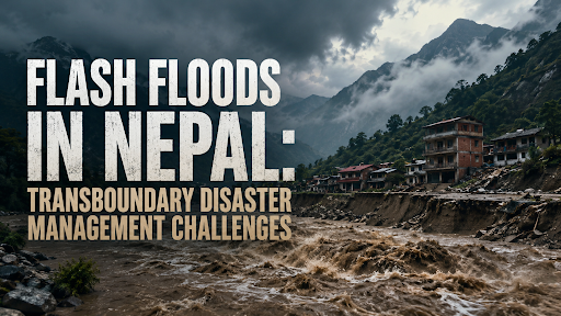
A glacial collapse and ice-rock avalanche along the Nepal-Tibet border caused flash floods in the Bhotekoshi and Trishuli river basins, triggering downstream emergency flood alerts in Bihar and Uttar Pradesh.
What is a Flash Flood?
According to National Disaster Management Authority -(NDMA), Flash Flood is a sudden, high-velocity surge of water that occurs within less than 6 hours of the causative event (such as intense cloudbursts, glacial collapses, dam breaches, or landslide dam failures).
Key Characteristics:
-
Rapid Onset and Peak Discharge: Characterized by a short lag time between precipitation/breach and the flood peak, leaving minimal evacuation response time.
-
High Debris and Sediment Load: Mountainous flash floods carry massive quantities of boulders, mud, and eroded topsoil, multiplying destructive kinetic energy downstream.
-
Funneling Topography: Steep Himalayan V-shaped river valleys act as natural funnels, concentrating dispersed floodwaters into narrow, violent torrents.
What is a GLOF (Glacial Lake Outburst Flood)?
It is the release of large volumes of water from a glacial lake formed by the melting of glaciers, dammed by unstable, loose moraines (glacial debris) or ice dams.
-
Triggering Mechanisms:
-
Ice/Rock Avalanches: Massive chunks of hanging glaciers or rock masses plunging into the lake, generating displacement waves that breach the moraine dam.
-
Earthquakes & Tectonic Shocks: Destabilising loose moraines in seismically active mountain belts.
-
Extreme Temperature & Melt Inflows: Rapid warming increases hydrostatic pressure behind the natural dam until catastrophic structural failure occurs.
-
Scale in Hindu Kush Himalayas: International Centre for Integrated Mountain Development (ICIMOD) identified over 3,600 glacial lakes across the Koshi, Gandaki, and Karnali river basins, with 47 classified as Potentially Dangerous Glacial Lakes (PDGLs) (25 located across the border in Tibet).

Why is Nepal Vulnerable?
Geologically Young & Fragile Terrain: Nepal sits squarely on the active convergence zone of the Indian and Eurasian tectonic plates (Main Himalayan Thrust), making slopes prone to frequent landslides and seismic fractures.
Steep Elevation Gradients: The elevation drops sharply from over 8,000 metres in the High Himalayas to under 100 metres in the southern Terai plains within a distance of just 150–200 kilometres, accelerating water flow velocity.
Cryospheric Degradation: Himalayan glaciers retreated by 24% between 1977 and 2010, causing glacial lakes to multiply and expand rapidly in volume. (Source: IPCC)
Dense Hydropower Infrastructure in High-Risk Gorges: Concentrating run-of-the-river hydropower plants in narrow, hazard-prone mountain valleys amplifies cascading asset destruction during flash floods.
Why is India Vulnerable?
Transboundary River Connectivity: All major river systems of Nepal—Kosi (Saptakoshi), Gandak (Narayani), Ghaghara (Karnali), Mahakali (Sharda), and Bagmati—drain directly into the Ganga river basin in northern India.

Share in North Bihar Inundation: Nepal's river catchments contribute over 70% of North Bihar's total floodwaters during the monsoon season, submerging flat agricultural plains in districts like Supaul, Saharsa, West Champaran, and Madhubani.
Extreme Sedimentation & River Avulsion: The Kosi river carries approximately 19 million tonnes of silt annually, depositing sediment on flat plains, raising riverbed levels, and causing frequent catastrophic course shifts (e.g., the 2008 Kasauni breach affecting 3.3 million people). (Source: Geological Survey of India)
High Population Density in Riparian Plains: Over 50 million people live in the flood-prone plains of North Bihar and Eastern Uttar Pradesh, making economic and human exposure exceptionally high.
What are the Major Transboundary Challenges for India?
Critical Lack of Real-Time Upstream Hydrological Data: India lacks real-time sensor and telemetry access to glacial lakes and rivers located in the upper reaches within the Tibet Autonomous Region (China) and remote northern Nepal.
Multi-Hazard Cascades: Simultaneous occurrences of earthquakes, slope failures, and glacial outburst floods create complex compound disasters that overwhelm standard single-hazard early warning protocols.
Transboundary Barrage Management Constraints: Managing water releases at the Kosi Barrage (Bhimnagar) and Gandak Barrage (Valmikinagar) requires delicate cross-border operational coordination between Indian and Nepalese engineers during extreme flood peaks.
Silt Accumulation Reducing Reservoir Capacity: Heavy silt accumulation in upstream catchments reduces the design holding capacity of cross-border flood control structures and canal networks.
Absence of a Trilateral Himalayan River Basin Treaty: No comprehensive institutional data-sharing mechanism exists between China, Nepal, and India to manage the common transboundary watercourses of the Ganga basin.
Institutional Framework in India For Flood Regulation
National Disaster Management Authority (NDMA): Apex statutory body under the Ministry of Home Affairs responsible for formulating national disaster policies, guidelines, and funding GLOF mitigation projects.
Central Water Commission (CWC): Operates an extensive network of over 330 flood forecasting stations across India, issuing daily hydro-meteorological advisories and 7-day basin flood forecasts.
State Disaster Management Authorities (SDMAs): Agencies such as the Bihar SDMA and UP SDMA coordinate on-ground district evacuation, community shelters, and emergency relief operations.
National Disaster Response Force (NDRF): Specialized multi-skilled force deployed with high-speed inflatable motorboats and dive rescue gear for rapid flood rescue operations.
Bilateral India-Nepal Water Mechanisms:
-
Joint Committee on Inundation and Flood Management (JCIFM): Reviews border flood mitigation works and embankment maintenance annually.
-
Joint Committee on Water Resources (JCWR): High-level ministerial mechanism steering long-term water cooperation, including the proposed Sapta Kosi High Dam project.
What India Can Learn from International Successful Models
Mekong River Commission (MRC) Telemetry Model: Cambodia, Laos, Thailand, and Vietnam share standardized real-time hydrological data, soil moisture levels, and automated flash flood alerts through a unified digital platform.
International Commission for the Protection of the Rhine (ICPR): European nations along the Rhine (Switzerland, France, Germany, Netherlands) implemented the "Room for the River" approach, restoring natural floodplains and transboundary retention basins rather than relying purely on concrete embankments.
Way Forward
Deploy Real-Time Transboundary Automated Weather and Water Telemetry: Install automated water level recorders, acoustic Doppler sensors, and satellite-linked rain gauges across upstream tributaries in Nepal to increase early warning lead times for downstream Bihar and Uttar Pradesh.
Strengthen Integrated Embankment & Nature-Based Floodplain Management: Shift from traditional piecemeal earthen dykes to bio-engineered embankments and natural wetland flood retention basins (e.g., Chaurs and Mauns of North Bihar) to absorb seasonal excess runoff.
Execute Targeted Siphoning and Lake-Lowering at Dangerous Glacial Lakes: Conduct joint Indian and Nepalese scientific engineering expeditions to mechanically lower water levels in the 47 high-risk glacial lakes using siphoning tubes and controlled spillway cuts.
Institutionalise a Trilateral Himalayan Cryosphere Task Force: Establish a formal scientific dialogue involving India, Nepal, and China under the auspices of regional scientific bodies to share satellite remote-sensing imagery and high-altitude weather data.
Empower Border Panchayats with Community-Based Early Warning (CBEWS): Equip local frontline village disaster management committees in border districts with solar-powered warning sirens, two-way wireless VHF radios, and localized emergency evacuation protocols.
Conclusion
Mitigating Himalayan flash floods requires transitioning from reactive downstream rescue to proactive, real-time transboundary telemetry, scientific glacial lake management, and integrated basin-wide river governance.
Source: INDIANEXPRESS
|
PRACTICE QUESTION Q. The increasing frequency of climate-induced flash floods and Glacial Lake Outburst Floods (GLOFs) in the Himalayas underscores the urgent need for a shift from national containment to transboundary river basin governance. Discuss (15 Marks, 250 Words) |



