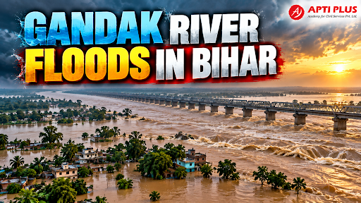
Why In News?
Torrential Nepal Himalayan rains forced 4.5–5 lakh cusec discharges through the Valmikinagar Barrage, flooding North Bihar's Gandak basin and straining embankments.
What is the Gandak River?
Himalayan River: A perennial, snow-fed and monsoon-fed transboundary river carrying immense seasonal water discharge and glacial sediment.
Origin in Nepal: Originates in the high Himalayas north of Dhaulagiri in the Tibetan border region of Nepal, known as the Kali Gandaki or Narayani in the Nepalese plains.
Entry into Bihar: Enters the plains of India at Triveni (Valmikinagar) in the West Champaran district of Bihar.
Tributary of the Ganga: Flows southeast across the north Bihar plains for approximately 300 km before outfalling as a major left-bank tributary into the Ganga River at Sonpur (near Patna).
Transboundary River: Forms a crucial international river basin shared between Nepal and India, governed under the historic bilateral Gandak Irrigation and Power Project Agreement (1959).
Gandak Basin: Drains a total catchment area of over 46,000 sq km, with the major upper mountainous basin lying inside Nepal.

River Course
Nhubine Himal Glacier → Kali Gandaki → Devghat → Narayani → India → Gandak → Ganga
-
In the upper Himalayas, it is called Kali Gandaki.
-
At Devghat, the Kali Gandaki and Trishuli systems converge, and the river is generally known as Narayani.
-
It enters India near Triveni/Valmikinagar and is called the Gandak.
-
It flows through the Gangetic plains and ultimately joins the Ganga near Sonpur.
Major Tributaries
The Gandaki system is also called Sapta Gandaki, referring to its major Himalayan tributary system.
Important tributaries include:
-
Kali Gandaki
-
Trishuli
-
Budhi Gandaki
-
Marsyangdi
-
Seti
-
Madi
-
Daraudi
The Trishuli is important because its confluence with the Kali Gandaki at Devghat forms the main Narayani system.
Geographical Significance
-
The basin contains three 8,000-metre-plus peaks: Dhaulagiri (8,167 m), Manaslu (8,163 m) and Annapurna I (8,091 m).
-
The Kali Gandaki Gorge lies between Dhaulagiri and Annapurna and is one of the world's deepest mountain gorges.
-
The river is considered older than the Himalayas in the geological interpretation presented in the source, having maintained its course while tectonic uplift raised the surrounding mountains.
-
The basin has substantial hydropower potential, particularly in Nepal.
What Causes Gandak Floods?
-
Intense Monsoon Precipitation: Concentrated spells of rainfall over the lower and middle plains of north Bihar.
-
Upstream Cloudbursts & Rainfall in Nepal: Intense precipitation in the steep Himalayan catchments of Nepal rapidly funnels into torrential surface runoff toward Bihar within 12 to 24 hours.
-
High River Discharge from Barrage: Sudden opening of all 36 sluice gates at the Valmikinagar Barrage during peak surges, releasing torrents into low-lying downstream areas.
-
Heavy Silt Load and Riverbed Aggradation: Himalayan silt chokes river channels, sharply diminishing carrying capacity and forcing the river to spill over its banks.
-
Embankment Breaches: Structural erosion, piping failures, and burrowing animal activity weaken earthen bunds, causing breaches under high hydraulic pressure.
-
Drainage Congestion from Infrastructure: Unplanned roads, railway embankments, and canals lack adequate culverts and cross-drainage, trapping backwaters.
-
Active River Migration: Lateral channel shifting and bank slumping across districts like West Champaran, Gopalganj, Saran, and Vaishali.
What are the Major Impacts?
-
Widespread Loss of Crops: Submergence of standing kharif crops (paddy, maize, sugarcane) over lakhs of hectares, leaving agricultural soil covered in unproductive coarse sand (balu-chhappi).
-
Damage to Rural Housing: Collapse of kutcha mud-and-thatch houses and structural cracking of semi-pucca village homesteads.
-
Road and Transport Disruption: Inundation of State Highways, rural link roads, and railway tracks, cutting off remote panchayats into isolated islands.
-
Loss of Livestock: Drowning of cattle, acute shortages of dry fodder, and rapid outbreaks of bovine waterborne infections.
-
Drinking Water Contamination: Submersion of shallow hand-pumps (chapakals) by contaminated flood surface water, precipitating severe potable water crises.
-
Heightened Public Health and Disease Risk: Escalating incidence of acute diarrheal diseases, cholera, leptospirosis, and vector-borne diseases like malaria and dengue.
-
Large-Scale Displacement: Millions of people forced to evacuate to raised national highway verges, railway platforms, and relief camps.
-
Erosion of Rural Livelihoods: Destruction of small businesses, loss of household savings, and distress migration of marginal farmers and farm laborers to industrial cities.
Why is Nepal Important for Gandak Flood Management?
Upper Catchment Control: Nearly 80% of the Gandak's total catchment area lies within Nepalese territory, meaning flood surges are determined by precipitation beyond Indian borders.
Transboundary Hydrological Dynamics: Topography dictates that water management in the plains cannot succeed without coordinated upstream intervention.
Real-Time Hydrological Data Sharing: Downstream early warnings in Bihar depend directly on real-time river gauge, rainfall, and discharge telemetry transmitted from Nepalese stations.
Joint Flood Forecasting Mechanisms: Bilateral cooperation is essential for calibrating predictive flood models before peak flood waves hit the Valmikinagar Barrage.
Reservoir and Barrage Coordination: Joint operational maintenance and silt management at the Valmikinagar Barrage and upstream storage dams are crucial for regulating high inflows.
Cross-Border Disaster Management: Joint monitoring teams and bilateral coordination between administrative officials (e.g., between West Champaran/Gopalganj and Nepal's Nawalparasi district) ensure timely flood relief and embankment repair.
What are the Major Disaster Management Measures?
Hydro-Meteorological Flood Forecasting: The Central Water Commission (CWC) operates river-monitoring telemetry stations issuing river stage forecasts and danger-level warnings.
Embankment Management & Anti-Erosion Works: Pre-monsoon boulder pitching, geo-bag stacking, and regular patrolling of vulnerable flood protection bunds.
Early-Warning Systems: Dissemination of localized village alerts via the Sachet mobile portal and SMS emergency cell-broadcast systems.
Pre-Positioned Evacuation & Rescue: Rapid deployment of National Disaster Response Force (NDRF) and State Disaster Response Force (SDRF) teams equipped with motorized inflatable boats.
Relief Camps & Community Kitchens: Setting up centralized temporary shelter tents and community kitchens providing warm meals, baby food, and clean drinking water tankers.
Raised Multi-Purpose Flood Shelters: Constructing permanent elevated disaster shelters above historical high-flood levels (HFL) to shelter vulnerable villagers and livestock.
Boat-Based Medical & Relief Distribution: Deploying mobile boat clinics equipped with chlorine tablets, ORS packets, anti-snake venom, and basic medicines.
Crop Insurance Compensation: Providing agricultural relief through the Pradhan Mantri Fasal Bima Yojana (PMFBY) and State Disaster Response Fund (SDRF) input subsidies.
Source: THEHINDU
|
PRACTICE QUESTION Q. With reference to the Gandak River and its flood dynamics in India, consider the following statements: 1. The Gandak River originates in the Himalayas of Nepal where it is known as the Narayani or Kali Gandaki. 2. It enters the Indian plains at Valmikinagar in Bihar and joins the Ganga River as a right-bank tributary near Patna. 3. The Valmikinagar Barrage regulates water discharge and irrigation canals across both India and Nepal. Which of the statements given above is/are correct? (a) 1 and 2 only (b) 2 and 3 only (c) 1 and 3 only (d) 1, 2 and 3 Answer: (c) Explanation: Statement 1 is correct: The Gandak River originates in the high Himalayas of Nepal and Tibet (near the Dhaulagiri massif) and is known as the Kali Gandaki or Narayani in Nepal. Statement 2 is incorrect: While the Gandak River does enter the Indian plains near Valmikinagar in Bihar and meets the Ganga near Patna/Hajipur (at Sonepur), it is a left-bank tributary of the Ganga, not a right-bank tributary. Statement 3 is correct: The Valmikinagar Barrage (also called the Gandak Barrage) located near the border regulates water discharge, flood flows, and joint Triveni Canal irrigation systems shared by both India and Nepal. |



