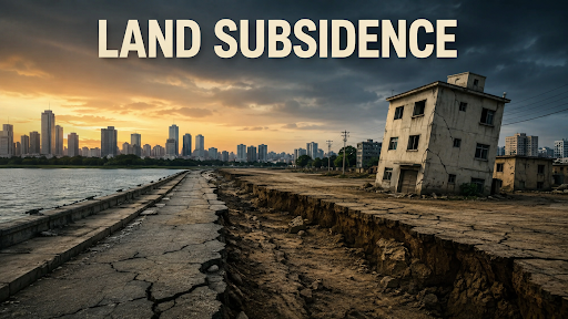
Why In News?
Extensive ground fissures and structural damage in villages across Uttarakhand's Bageshwar district triggered urgent safety alarms over unscientific open-cast and underground soapstone mining destabilizing fragile Himalayan slopes.
What is Land Subsidence?
Land subsidence is the gradual settling, sinking, or sudden downward collapse of the Earth's surface caused by the subsurface removal, compaction, or displacement of geological materials (soil, rock, water, or minerals).
-
Gradual Ground Sinking: Slow, progressive vertical settlement of ground layers over months or years, often escaping early visual detection until structural cracks manifest on surface buildings.
-
Differential Subsidence: Uneven ground sinking where one portion of a slope or building foundation settles faster than adjacent areas, inducing intense shearing stress and fracturing walls, foundations, and roads.

Natural Subsidence Causes:
-
Tectonic Activity: Active fault movements and crustal adjustments along seismic fault lines (e.g., Main Central Thrust - MCT and North Almora Thrust - NAT).
-
Karst Dissolution: Natural chemical weathering and subterranean cave formation in soluble limestone or dolomite rock formations.
-
Sediment Consolidation: Natural compaction of loose, unconsolidated glacial moraines and ancient landslide debris.
Human-Induced (Anthropogenic) Subsidence Causes:
-
Underground and Open-Cast Mining: Excavation of mineral seams without backfilling (void collapse).
-
Excessive Groundwater Extraction: Depleting aquifers causing soil pore spaces to collapse.
-
Heavy Infrastructure Overload: Constructing multistory concrete buildings on steep slopes exceeding local carrying capacity.

What Causes Land Subsidence in Bageshwar?
Unregulated Open-Cast and Underground Mining: Bageshwar holds India's richest deposits of high-grade soapstone (steatite/talc) and magnesite.
-
Widespread mechanical excavation creates hollow subterranean chambers without compulsory rock bolting or sand backfilling.
Excessive Vertical Hill Cutting: Mining contractors cut near-vertical benches (70°–80° slope angles) rather than safe step-benches, stripping the protective toe-support of mountain slopes.
Weak Tectonic and Geological Structure: The Kumaon Himalayas lie in Seismic Zone V, transected by the North Almora Thrust (NAT). The bedrock consists of sheared, highly fractured phyllites, schists, and dolomites that weather rapidly upon exposure.
Blockage of Natural Drainage: Discarded mine waste and muck dumped into hill gullies prevent surface runoff, forcing water to percolate into subsurface shear zones, lubricating slip planes.
Extreme Monsoon Downpours: High-intensity cloudbursts (exceeding 100 mm/hour) saturate fractured strata, triggering simultaneous land subsidence and mass debris flows.
Historical Landslide Debris Foundation: Many settlements in Bageshwar and Joshimath are perched on old, unconsolidated landslide deposits rather than solid bedrock.
What is the Link Between Mining and Subsidence?
|
What are the Environmental Concerns?
Severe Soil Degradation & Topsoil Erosion: Stripping vegetative cover and forest soil for mining pits triggers accelerated gullying and sheet erosion.
Slope Instability & Micro-Geomorphic Imbalance: Altering natural mountain profiles creates unstable slope gradients vulnerable to gravity-driven mass wasting.
Disturbance of Himalayan Hydrology: Debris dumping chokes headwater tributaries of the Saryu and Gomti river basins in Uttarakhand.
Disruption of Natural Springs (Naulas & Dharas): Subsurface fracturing redirects underground springs, depleting drinking water sources for downstream hamlets.
Habitat Fragmentation & Ecosystem Damage: Open mining degrades oak (Quercus) and pine forest ecosystems, driving away indigenous Himalayan wildlife.
What are the Governance Challenges?
Gaps in Mining Regulation & Monitoring: Limited enforcement capacity in district mining departments allows miners to deploy unauthorized heavy excavators and blast beyond permissible limits.
Compromised Environmental Impact Assessment (EIA): Mining leases are frequently split into parcels smaller than 5 hectares to bypass rigorous Central environmental clearance under the EIA Notification 2006.
Neglect of Progressive Mine Closure Plans: Contractors abandon exhausted soapstone pits without biological reclamation, slope terracing, or compulsory afforestation.
Absence of High-Resolution Risk Mapping: Lack of micro-level landslide hazard zonation and Interferometric Synthetic Aperture Radar (InSAR) ground monitoring maps at the tehsil level.
Inadequate Rehabilitation Policies: Protracted delays in disbursing structural compensation and providing safe resettlement land to affected hill villagers.
Fragmented Inter-Agency Coordination: Poor institutional synergy among the Mining Department, Disaster Management Authority, Forest Department, and District Administration.
Way Forward
Mandatory Independent Geotechnical and Carrying-Capacity Audits: Conduct comprehensive multi-sensor InSAR satellite deformation mapping and slope stability audits before granting or renewing mining leases in eco-sensitive zones.
Strict Mining Moratorium in High-Vulnerability Zones: Enforce an immediate suspension of all mining activities within 500 meters of inhabited village boundaries, major thrust fault lines, and active landslide zones.
Scientific Mine Planning & Mandatory Backfilling: Enforce bench mining with maximum 45° slope angles, rock-bolting, and concurrent backfilling of excavated trenches with compacted non-toxic waste.
Ecological Restoration of Blocked Drainage Networks: Clear mining overburden from natural streams (gadheras) and construct engineered masonry catch-water drains along vulnerable slopes to divert monsoon runoff safely.
Bio-Engineering for Slope Stabilisation: Plant deep-rooting native soil-binding species (such as Alnus nepalensis and vetiver grass) coupled with wire-mesh gabion walls and geo-textiles on exposed cut-slopes.
Deploy Multi-Sensor Early-Warning Systems (EWS): Install automated ground piezometers, tiltmeters, and extensometers linked to local district emergency operation centres for real-time subsidence alerts.
Risk-Based Land-Use Zoning: Demarcate "No-Construction" and "Regulated-Construction" zones based on geotechnical slope stability ratings in town planning bye-laws.
Time-Bound Resettlement and Fair Compensation: Formulate a dedicated Himalayan Rehabilitation and Resettlement Policy providing land-for-land and climate-resilient prefabricated housing in safe valley zones.
Conclusion
Mitigating land subsidence in the fragile Himalayas demands an urgent transition from extractive unscientific mining to risk-informed land-use planning, strict geotechnical regulations, and community-centric ecological restoration.
Source: NEWINDIANEXPRESS
|
PRACTICE QUESTION Q. With reference to the geological and environmental factors causing land subsidence in the Himalayan region, consider the following statements: 1. The presence of major tectonic faults such as the Main Central Thrust (MCT) increases the natural fragility of the rock strata. 2. Dumping of unscientific mining overburden in natural streams decreases pore-water pressure inside mountain slopes. 3. Differential subsidence occurs when different parts of a landmass settle at unequal rates, leading to structural shearing. Which of the statements given above are correct? (a) 1 and 2 only (b) 2 and 3 only (c) 1 and 3 only (d) 1, 2, and 3 Answer: (c) 1 and 3 only Explanation: Statement 1 is correct: The Main Central Thrust (MCT) is a major active tectonic fault zone in the Himalayan region. The ongoing tectonic activity and immense subterranean stress along the MCT lead to continuous rock fracturing, crushing, and deformation. This significantly increases the natural fragility and instability of the rock strata, making the surrounding slopes highly prone to land subsidence and landslides. Statement 2 is incorrect: Dumping unscientific mining overburden and debris into natural streams blocks the natural drainage and chokes the waterways. This forces the water to seep into the surrounding mountain slopes, which increases (rather than decreases) the pore-water pressure. High pore-water pressure reduces the shear strength of the soil and rock mass, thereby destabilizing the slope and accelerating land subsidence. Statement 3 is correct: Differential subsidence happens when adjacent areas of a landmass settle downward at different speeds or to varying depths. This uneven ground movement creates severe torsional stresses and structural shearing, causing buildings, roads, and foundations to tear apart and develop cracks. |



