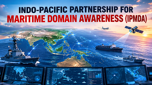
Why In News?
To safeguard global trade and navigation amid regional geopolitical tensions, maritime security experts urged accelerating the Indo-Pacific Partnership for Maritime Domain Awareness (IPMDA).
What is IPMDA?
The Indo-Pacific Partnership for Maritime Domain Awareness (IPMDA) was launched by the leaders of the Quadrilateral Security Dialogue (Quad)—India, the United States, Australia, and Japan—during the Tokyo Summit in 2022.
It is a transparent, non-treaty public-goods platform that provides commercial satellite-based tracking data and analytical software to regional coast guards and maritime law enforcement agencies.
It integrates information-sharing networks across the Indian Ocean Region (IOR), Southeast Asia, and the Pacific Island Forum.

Objectives of IPMDA
Monitoring Maritime Activity: Generates a near-real-time, common operating picture of merchant shipping and fishing traffic across the Indo-Pacific.
Tracking "Dark Shipping": Detects rogue vessels that intentionally disable their Automatic Identification System (AIS) transponders to evade national radar networks.
Improving Maritime Transparency: Democratizes access to high-grade commercial satellite data for small island nations that lack sovereign space or naval assets.
Supporting Maritime Security: Assists littoral states in interdicting sea-borne piracy, contraband smuggling, armed robbery, and maritime terrorism.
Strengthening Disaster Response (HADR): Provides rapid maritime situational feeds to coordinate responses during tsunamis, tropical cyclones, search-and-rescue, and marine oil spills.
Protecting Marine Resources & Countering IUU Fishing: Curbs Illegal, Unreported, and Unregulated (IUU) fishing, which inflicts over $23 billion in annual global economic losses.

What Technologies are Used in IPMDA?
Commercial Space-Based Radio Frequency (RF) Data: Low-Earth-orbit satellite constellations (e.g., HawkEye 360) detect electromagnetic emissions from marine navigation radars, satellite phones, and VHF radios, exposing non-transponding vessels.
Synthetic Aperture Radar (SAR) Imagery: Spaceborne radar penetrates cloud cover, monsoons, and nighttime darkness to image vessel hulls and measure ship dimensions accurately.
Automatic Identification System (AIS) Data: Terrestrial and satellite-based AIS receivers aggregate real-time broadcast telemetry (MMSI, position, speed, destination).
Electro-Optical (EO) & Infrared (IR) Satellite Imagery: High-resolution optical sensors verify vessel identities, flag markings, and gear types during daylight.
Web-Based Analytical Fusion Platforms (SeaVision): Integrates multi-sensor datasets into an intuitive visualization software accessible to regional maritime agencies via secure web portals.
Artificial Intelligence & Predictive Analytics: Machine learning algorithms analyze historical shipping trajectories to identify anomalous behavior (e.g., mid-ocean ship-to-ship transfers, loitering near submarine cables).
Why is IPMDA Important for India?
Securing the Indian Ocean Region (IOR): Bolsters surveillance across India’s 2.37 million sq. km Exclusive Economic Zone (EEZ) and vital maritime approaches.
Operationalising the SAGAR & MAHASAGAR Visions: Complements India's Security and Growth for All in the Region (SAGAR) and its 2025 expansion Mutual and Holistic Advancement for Security and Growth Across Regions (MAHASAGAR) by positioning India as a preferred regional security partner and net security provider.
Enhancing the Role of IFC-IOR (Gurugram): Serves as a vital nerve center for IPMDA, hosting International Liaison Officers (ILOs) from over 16 partner nations and sharing white-shipping intelligence with 25+ countries.
Monitoring Extra-Regional Naval & Research Incursions: Tracks unauthorized oceanographic survey vessels and dual-use intelligence-gathering ships operating near Indian maritime boundaries and sensitive island territories (Andaman & Nicobar, Lakshadweep).
Strengthening Anti-Piracy & Anti-Narcotics Missions: Provides precision intelligence for Indian Navy surface warships intercepting hijacked merchant ships and narco-dhows across the Arabian Sea and Western Indian Ocean.
Protection of Critical Sea Lines of Communication (SLOCs): Safeguards sea lanes carrying over 90% of India's international trade by volume and 70% by value.
What are the Major Challenges?
Geopolitical Sensitivities & "Quad Entanglement" Fears: Certain ASEAN and Indian Ocean littoral nations hesitate to openly adopt Quad initiatives due to concerns over regional non-alignment and diplomatic friction.
Technical Interoperability & Software Integration Gaps: Disparate national command-and-control software architectures complicate seamless API data exchanges between regional fusion centers.
High Recurring Subscription Costs for Satellite Feeds: Commercial RF (HawkEye 360) and high-resolution SAR data feeds require sustained multilateral funding commitments.
Cybersecurity Vulnerabilities in Cloud Fusion Hubs: Centralized maritime databases remain prime targets for state-backed advanced persistent threat (APT) cyberattacks.
Maritime Enforcement Capability Asymmetry: While IPMDA provides real-time situational data, small island developing states (SIDS) frequently lack sufficient offshore patrol vessels (OPVs) to intercept violators.
Data Sovereignty & Classification Barriers: Restrictions under national laws prevent states from sharing classified naval tracking data on public-goods platforms.
Way Forward
Expand Regional Participation Across IORA and ASEAN: Institutionalize IPMDA data linkages with the Indian Ocean Rim Association (IORA), BIMSTEC, and the ASEAN Maritime Forum to emphasize its non-military, public-goods character.
Bridge Awareness with Maritime Enforcement Capacity: Couple satellite data delivery with capacity-building programs, including transferring Fast Patrol Craft, surveillance drones, and training teams to littoral partners.
Upgrade IMAC into the Multi-Agency NMDA Center: Fast-track the implementation of the AI-enabled National Maritime Domain Awareness Network with Bharat Electronics Limited.
Develop Indigenous Space-Based RF & SAR Constellations: Mobilize ISRO and domestic defense space startups to build sovereign maritime surveillance satellites, reducing reliance on foreign commercial vendors.
Standardize Secure Interoperable Data Protocols: Establish open-standard APIs with end-to-end post-quantum cryptographic security for real-time data exchange across fusion centers.
Institutionalize Joint Coast Guard Operations: Leverage the Quad at Sea Ship Observer Mission and the "Quad Coast Guard Handshake" to conduct coordinated multilateral maritime patrols.
Enforce Strict International Sanctions on Dark Shipping: Lead multilateral negotiations at the International Maritime Organization (IMO) to penalize vessels that deliberately disable AIS transponders in international waters.
Conclusion
By transforming raw commercial satellite telemetry into actionable maritime intelligence, IPMDA serves as a cornerstone of Indo-Pacific security, safeguarding sea lanes and cementing India's role as a net security provider under the SAGAR vision.
Source: THEHINDU
|
PRACTICE QUESTION Q. With reference to the 'Indo-Pacific Partnership for Maritime Domain Awareness (IPMDA)', consider the following statements: 1. It is a legally binding multilateral defense treaty signed under the auspices of the United Nations Convention on the Law of the Sea (UNCLOS). 2. It fuses commercial satellite radio frequency (RF) data with automatic identification system (AIS) signals to detect non-transponding dark vessels. 3. The Information Fusion Centre – Indian Ocean Region (IFC-IOR) at Gurugram serves as one of the regional information-sharing hubs under this initiative. Which of the statements given above are correct? (a) 1 and 2 only (b) 2 and 3 only (c) 1 and 3 only (d) 1, 2, and 3 Answer: (b) 2 and 3 only Explanation: Statement 1 is incorrect: The Indo-Pacific Partnership for Maritime Domain Awareness (IPMDA) is not a legally binding defense treaty signed under the United Nations Convention on the Law of the Sea (UNCLOS). Instead, it is a non-binding, technology-driven multilateral security and surveillance initiative launched by the Quad leaders (Australia, India, Japan, and the United States) during the May 2022 Tokyo Summit. Statement 2 is correct: IPMDA harnesses commercial satellite Radio Frequency (RF) data collection, Synthetic Aperture Radar (SAR), and combines it with Automatic Identification System (AIS) signals. This data fusion allows partner countries to detect "dark vessels" (ships that deliberately turn off their AIS transponders to evade tracking) and counter illegal, unreported, and unregulated (IUU) fishing. Statement 3 is correct: IPMDA works by integrating with existing regional fusion hubs across the Indo-Pacific rather than building entirely new institutional infrastructure. India's Information Fusion Centre – Indian Ocean Region (IFC-IOR) located at Gurugram serves as one of the key regional information-sharing nodes alongside centres in Singapore, Vanuatu, and the Solomon Islands. |



