Why In News?
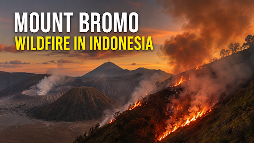
Since 3 August 2026, a wildfire inside Bromo Tengger Semeru National Park, East Java, has destroyed over 127 hectares.
What is Mount Bromo?
Mount Bromo is an active volcano in East Java, Indonesia, located within the Bromo Tengger Semeru National Park (TNBTS).
Bromo is surrounded by the Tengger Caldera and the Tengger volcanic massif, a massive volcanic complex in East Java, Indonesia.
TNBTS covers around 800 km² and includes Mount Bromo and Mount Semeru, with Semeru being Java's highest peak at 3,676 m.
The surrounding Tenggerese community, predominantly Hindu, considers Bromo sacred and conducts the annual Yadnya Kasada ritual involving offerings at the volcano.
Bromo is internationally known for its sunrise landscape, volcanic crater and Sea of Sand.
What is Wildfire?
A wildfire is an unplanned, uncontrolled fire that burns through combustible vegetation in natural landscapes such as forests, grasslands, brushlands, or tundra.
The behavior and intensity of a wildfire depend heavily on three components known as the fire triangle: fuel (dry plants, leaves, and wood), oxygen, and a heat source.
-
Types of Blazes: Wildfires expand in three different ways:
-
surface fires which burn slowly along the forest floor;
-
ground fires which smoulder deep within organic soil matter;
-
crown fires which quickly leap across tree canopies, propelled by high winds.
-
Speed and Spread: Fueled by high winds, high temperatures, and steep topography.

Wildfires Management In India
Prevention & Risk Reduction
-
Fire-risk mapping: Forest Survey of India (FSI) identifies fire-prone zones using 5×5 km grids, enabling targeted deployment of crews and equipment.
-
Fuel-load management: Controlled burning, removal of dry biomass and creation of fire lines can reduce fuel continuity and fire intensity, especially in dry deciduous forests.
-
Community participation: Train forest-dependent communities as first responders and incentivise early reporting, since many forest fires originate from human activities.
Early Warning & Detection
-
Satellite surveillance: FSI uses MODIS sensors for near-real-time detection, with alerts disseminated to State Forest Departments multiple times daily.
-
Fire Weather Index: FSI combines weather, fuel moisture and terrain to classify fire danger into five levels, allowing preventive mobilisation before ignition.
-
Van Agni portal: Integrate satellite alerts, fire boundaries and danger ratings into district-level dashboards for faster incident command.
Rapid Response
-
Incident-command system: Establish unified coordination among Forest Departments, District Administration, SDMA, NDMA and emergency services for large fires.
-
Strategic deployment: Prioritise crews, water carriers and equipment in high-risk zones; FSI estimates 10.66% of India's forest cover falls in extremely to very highly fire-prone categories.
-
Technology-enabled firefighting: Use drones, thermal imaging and GIS-based fire-perimeter mapping for inaccessible terrain and night operations.
Landscape & Climate Resilience
-
Restore fire-resilient ecosystems: Replace highly flammable monocultures with ecologically appropriate native vegetation and restore degraded landscapes.
-
Climate adaptation: Integrate heat, drought and fuel-moisture forecasts into annual fire-management plans because hotter and drier conditions can increase fire-weather risk.
Post-Fire Recovery
-
Burnt-area assessment: Use satellite-derived burn scars to prioritise restoration, erosion control and regeneration rather than indiscriminate plantation.
-
Ecological restoration: Protect natural regeneration, restore watersheds and monitor invasive species after fires to prevent secondary ecosystem degradation.
Source: THEJAKARTAPOST
|
PRACTICE QUESTION Q. Mount Bromo, recently in the news for wildfires, is located in which national park? (a) Ujung Kulon National Park (b) Bromo Tengger Semeru National Park (c) Komodo National Park (d) Gunung Leuser National Park Answer: (b) Explanation: Mount Bromo is located in (b) Bromo Tengger Semeru National Park in East Java, Indonesia, which has faced recent wildfire containment challenges during the dry season. |



