Why In News?
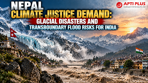
Following flash floods and Glacial Lake Outburst Floods (GLOFs), Nepal urged the UN General Assembly (UNGA) for Climate Justice, financial liability, and compensation from major emitters.
Nepal's Shift from Disaster Relief to Climate Compensation
Transition to Legal Liability: Kathmandu has abandoned the traditional "friendly first responder" relief framework, replacing it with claims grounded in Climate Justice and state liability under the UNFCCC.
Appealing to Global Mechanisms: Nepal submitted formal claims to the Fund for Responding to Loss and Damage (FRLD), demanding non-debt concessional climate finance and direct compensation for irreversible structural destruction.
Macroeconomic Damage Scale: Nepal's official post-disaster assessment calculated a reconstruction burden of $4.78 billion, which equals nearly 10% of its total Gross Domestic Product (GDP).
Pressure on Regional Neighbors: While Kathmandu clarified that it does not blame direct legal culpability to any single neighboring state, it explicitly pressed India and China for transboundary co-underwriting, real-time data sharing, and joint ecological resilience funding.

Climate Risks in the Himalayan Region
The Hindu Kush Himalaya (HKH) holds 63,700 glaciers covering 55,782 sq km and storing 5,736 cubic km of ice reserves. (Source: ICIMOD Report)
-
Between 1990 and 2020, HKH glaciers lost 12% of their total area and 9% of their ice volume.
-
Glacier mass loss has accelerated sharply, with average annual mass loss reaching 9 cm of water equivalent per decade post-2000.
Flash Flood and Glacial Hazard Concerns
-
Cascading Disasters: Rising temperatures cause thermal thawing and slope instability, leading to rockfalls and ice avalanches that dam rivers and form fragile lakes.
-
Rapid Surge Rates: During the Rasuwa flash flood in Nepal, water levels in the Trishuli River at Galchchi rose by 9 meters in just 30 minutes due to a massive influx of water, ice, and debris.
-
Over 489 GLOFs have been recorded in the HKH region since the 1800s, posing an escalating threat to mountain settlements and downstream infrastructure.
Major Himalayan Climate Risks
-
Glacial Lake Outburst Floods (GLOFs): Sudden ruptures of natural moraine dams releasing millions of cubic meters of water and sediment downstream.
-
Glacier Instability: Smaller glaciers (under 0.5 sq km) on steep east/southeast-facing slopes are shrinking fastest, causing localized water insecurity. Larger glaciers face long-term volume reduction that threatens perennial river discharge.
-
Flash Floods & Landslides: Seismic activity combined with heavy monsoon precipitation causes high-altitude rock and ice collapses. For example, the 2015 Gorkha earthquake triggered 25,000 landslides across 30,000 sq km, while the 2021 Chamoli disaster in Uttarakhand involved a collapse of 27 million cubic meters of rock and ice.
-
Changing River Flows: Rapid ice retreat alters seasonal runoff patterns, increasing wet-season flood peaks while reducing dry-season water availability for river basins supporting over 650 million people.
Transboundary Impact on India
Because the upper catchments of major Himalayan river systems lie in Nepal, high-altitude GLOFs and cloudbursts rapidly cross national borders into India.
-
Hydrological Link: The Bhote Koshi and Trishuli rivers merge at Devghat to form the Narayani River, which enters Bihar as the Gandak River.
-
Asymmetric Catchment: Out of the Gandak basin's total catchment area of 40,553 sq km, 35,470 sq km (87.5%) lies upstream in Nepal, compared to 4,188 sq km in Bihar and 895 sq km in Uttar Pradesh.
-
Downstream Inundation: Flood surges compel emergency water releases at the Valmiki Nagar Barrage (e.g., releasing over 150,000 cusecs through all 36 opened floodgates), threatening North Bihar districts like West Champaran, East Champaran, Gopalganj, Muzaffarpur, and Vaishali.

Challenges In Managing Transboundary River
Accelerating Climate Change: Warming at high altitudes accelerates glacier melt and destabilizes mountain slopes far faster than historical baseline projections.
-
Example: Rasuwa Flash Flood Incident (2026), a sudden GLOF and debris surge along the Bhote Koshi-Trishuli river corridor caused over 1,100 fatalities, displaced thousands, and damaged transboundary energy assets .
Data Gaps & Unmonitored Glaciers: Out of 63,700 glaciers across the Hindu Kush Himalaya, field-based mass balance measurements exist for only 38 glaciers (with active series on just 19), severely hindering predictive hazard modeling.
Limited Early-Warning Coverage: High-altitude tributaries lack automated weather and hydrological sensors, allowing sudden flash floods to move unmonitored.
-
Example: ICIMOD Cryosphere Observational Deficit Assessment, field-wide glaciological measurements are active on only 38 out of 63,700 glaciers across the Hindu Kush Himalaya due to rugged terrain and fragmented regional scientific cooperation.
Bureaucratic Financing Delays: Multilateral windows like the Green Climate Fund (GCF) take years to disburse funds; a $49.9 million GLOF risk-reduction project for Nepal sat in the GCF pipeline for over 7 years before clearance.
Strategic Secrecy Surrounding Hydrological Data: Transboundary water and glacier data are often treated as sensitive national security information rather than a public safety resource.
-
Geopolitical standoffs can disrupt critical data flows, such as when China unilaterally suspended Brahmaputra hydrological data sharing with India during the 2017 Doklam standoff.
Basis Risk in Index-Based Trigger Systems: Satellite-triggered parametric insurance models can suffer from "basis risk"—where measured index thresholds fail to capture localized ground devastation.
-
A similar gap between weather-index triggers and actual on-ground losses has affected agricultural schemes like Pradhan Mantri Fasal Bima Yojana.
Way Forward
Shared Early-Warning Systems: Expand automated digital river gauges and weather stations across high-altitude catchments in Nepal with direct satellite integration.
Real-Time Hydrological Data Sharing: Route glaciological and hydrological data through open-access civilian platforms with automated publishing to eliminate delays.
Mountain-to-River Intelligence Network: Construct an integrated warning grid connecting ISRO synthetic aperture radar, seismological sensors, automated digital river gauges, and artificial intelligence predictive modeling.
-
Linking upstream high-altitude monitoring directly to downstream barrage control rooms ensures maximum lead time for evacuations..
Himalayan Digital Twin: Develop a dynamic, continuously updated digital simulation of Himalayan river basins.
-
By modeling interconnected hazard chains—such as rock avalanches damming rivers, temporary lake formations, and breach surges—authorities can predict flood paths, evaluate infrastructure exposure, and pre-plan evacuation routes before disasters strike
Integrated Grey-Green-Blue Infrastructure Strategy: Shift mountain development away from concrete-only engineering toward a balanced tripartite framework:
-
Grey Infrastructure: Seismically resilient check dams, retaining structures, and spillway gates.
-
Green Infrastructure: Slope vegetation, upper watershed afforestation, and ecological soil stabilization.
-
Blue Infrastructure: River corridor conservation, natural wetland preservation, and strict floodplain zoning.
South Asian Resilience and Insurance Facility: India can lead the creation of a rapid-payout parametric insurance pool anchored in regional development banks like the New Development Bank (NDB), the Asian Infrastructure Investment Bank (AIIB), or BIMSTEC.
-
Releasing capital automatically upon satellite detection of climate triggers provides predictable reconstruction funds without invoking fault-based legal liability terms
Open-Access Civilian Data Sharing Grid: Institutionalize GLOF tracking, lake volume monitoring, and meteorological data onto an open-access civilian platform with automated publishing to ensure continuous real-time alerts regardless of diplomatic fluctuations.
Conclusion
India must transition from an emergency aid donor to a co-underwriter of Himalayan ecological resilience by deploying automated transboundary early warnings, balancing regional cooperation with legal liability.
Source: INDIANEXPRESS
|
PRACTICE QUESTION Q. Examine the need for transboundary disaster management cooperation between India and Nepal in the Himalayan region. 150 words |



