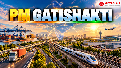
Why In News?
The PM GatiShakti National Master Plan (PMGS-NMP) completed five years of operation in October 2026, evolving from a digital mapping portal into a comprehensive GIS-based planning framework.
What Is PM GatiShakti National Master Plan?
It was launched in October 2021, the PM GatiShakti National Master Plan (PMGS-NMP) is an integrated GIS-based digital platform developed indigenously under Atmanirbhar Bharat by the Bhaskaracharya National Institute for Space Applications and Geo-informatics (BISAG-N).
-
BISAG is a Scientific Society under the Ministry of Electronics & IT facilitating in implementing map-based GeoSpatial Information Systems.
Governance Structure: It operationalizes a Whole-of-Government model by federating spatial data across 58 Central Ministries and Departments and all 36 States and Union Territories onto a single planning interface.
Geospatial Repository: The platform integrates over 1,800 core data layers and 23,493 geospatial sub-layers mapping trunk infrastructure, economic nodes, demographic zones, and forest boundaries to enable data-driven decision-making.
Why Was PM GatiShakti Introduced?
Dismantling Infrastructure Silos: Uncoordinated, departmental infrastructure execution historically generated asynchronous project timelines, repeated utility re-excavations, and cost overruns that inflated national logistics costs.
Multi-Scheme Spatial Convergence: The platform synchronizes major central infrastructure programs including Bharatmala Pariyojana, Sagarmala Programme, UDAN Scheme, Inland Waterways, and Dedicated Freight Corridors (DFC).
Six Core Guiding Principles: It institutionalizes six strategic principles to optimize project life-cycles: Integrated Development, Multimodal Infrastructure, Last-Mile Connectivity, Expedited Land Acquisition, Minimized Clearances, and Reduced Ecological Impact.
What Are The Core Pillars Of PM GatiShakti?
Seven Core Infrastructure Engines: Concentrates capital development across Roads, Railways, Ports, Waterways, Airports, Mass Transport, and Logistics Infrastructure.
Three-Tier Governance Mechanism:
-
Empowered Group of Secretaries (EGoS): Chaired by the Cabinet Secretary, directing macro-policy alignment and approving National Master Plan modifications.
-
Network Planning Group (NPG): Comprises Heads of Network Planning Divisions across infrastructure ministries to execute technical screening, route optimization, and cross-sectoral project appraisals.
-
Technical Support Unit (TSU): Employs subject-matter experts embedded within the Logistics Division under the Department for Promotion of Industry and Internal Trade (DPIIT).
Unified Digital Logistics Backbone:
-
Unified Logistics Interface Platform (ULIP): Integrates 46 government systems across 12 Central Ministries via 142 APIs (Application Programming Interface) for unified digital supply-chain visibility.
-
Logistics Data Bank (LDB): Provides real-time RFID tracking for EXIM container movement across ports and freight corridors.
-
Integrated Transport and Logistics Authority (ITLA): Formulates a statutory 10-year National Transport Master Plan, conducts technical appraisals for projects costing ₹500 crore or more, and manages the National Transport Data Repository (NTDR) synthesizing FASTag, Vahan, and GSTN e-way bills.
-
Gati Shakti Vishwavidyalaya (GSV): Central university in Vadodara providing specialized capacity building, having trained over 2.4 lakh government officials in logistics and infrastructure design.
What Are The Impacts Of PM GatiShakti?
Scale of Capital Appraisal: The Network Planning Group (NPG) evaluated 421 mega infrastructure projects valued at ₹20.23 lakh crore, with 256 projects sanctioned and 198 under implementation worth ₹18.66 lakh crore.
Ecological De-Risking & Fuel Savings: On the 699 km Pune–Bengaluru Expressway, GIS route optimization reduced forest land overlap by 19%, saving 16 crore litres of fuel annually and cutting carbon emissions by 39 crore kg. (Source: PIB)
Northeast Corridor Transit Optimization: Construction of the Jogighopa Multimodal Logistics Park in Assam, integrated with the Dhubri–Phulbari bridge, reduced regional transit distance from 205 km to 20 km and travel time from 7 hours to 30 minutes. (Source: PIB)
Green Energy Evacuation: Accelerated clearance for the Ladakh–Haryana Green Energy Corridor, facilitating a 480-km HVDC transmission line to evacuate 13 GW of renewable energy. (Source: PIB)
Social Sector & District Master Planning: Onboarded 22 Social Sector Ministries with 200+ data layers, including spatial mapping of 53,029 anganwadis in Gujarat to optimize child-care infrastructure under Mission Poshan 2.0.
What Challenges Does PM GatiShakti Face?
Map Discrepancies: Incomplete digitisation and conflicting state revenue records create discrepancies between digital GIS coordinates and ground boundaries, delaying land surveys.
Sub-National Data Asymmetry: Municipal local bodies and regional urban development authorities lag behind central line ministries in updating municipal GIS data layers in real time.
Statutory Land Acquisition Litigation: Spatial clearance speeds up technical project approvals but does not bypass legal disputes or compensation litigation under the Right to Fair Compensation and Transparency in Land Acquisition, Rehabilitation and Resettlement Act, 2013 (LARR Act, 2013).
Private Sector Data Access Limits: Concessionaires face compliance restrictions on uploading proprietary telemetry or accessing high-resolution datasets via ULIP APIs.
Macro-Over-Micro Alignment Bias: The Master Plan prioritizes major national expressways while often excluding Gram Panchayat roads and agricultural mandi feeder links.
Way Forward
Transition to 3D Digital Twins: Upgrade 2D GIS data layers into dynamic 3D Digital Twin models to simulate slope physics, subterranean utility networks, and flash-flood hydrologies prior to civil excavation.
Incentivize Sub-National GIS Syncing: Link central capital devolution grants under the Scheme for Special Assistance to States for Capital Investment to the complete digitisation and real-time syncing of district cadastral maps.
Democratize Private-Sector Interoperability: Expand regulated API interfaces for private infrastructure developers to submit spatial alignment proposals directly to the Network Planning Group (NPG).
Mandate Outcome-Based Logistics Metrics: Shift monitoring from physical construction milestones to real-time tracking of national logistics costs via ITLA, targeting a reduction from 13–14% down to 8–9% of GDP.
Gram Panchayat Micro-Logistics Integration: Extend the spatial grid down to the village level to link primary health sub-centers, rural agro-warehouses, and Pradhan Mantri Gram Sadak Yojana (PMGSY) roads into the national transport grid.
Conclusion
PM GatiShakti has re-engineered India's infrastructure governance from fragmented departmental execution into a synchronized, geospatial decision-making ecosystem vital for achieving Viksit Bharat
Source: PIB
|
PRACTICE QUESTION Q. How does the PM GatiShakti National Master Plan transition India from siloed infrastructure planning to a synchronized geospatial ecosystem, and what institutional bottlenecks hinder its ground-level execution? 150 WORDS |