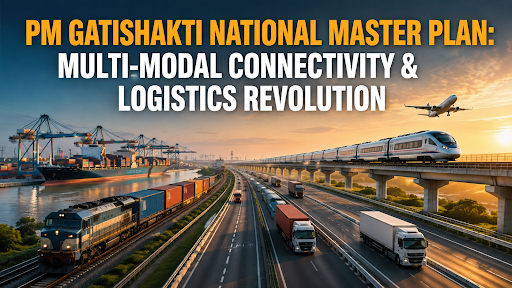
Why In News?
The Ministry of Electronics and IT (MeitY) partnered with digital payment ecosystem leaders to integrate hyperlocal economic data into the PM GatiShakti framework.
About PM GatiShakti National Master Plan
Origin: Launched in 2021, PM GatiShakti is a digital platform that unites 58 Central Ministries and all 36 States/UTs to plan and execute multi-modal connectivity projects without departmental silos.
Developed by BISAG-N (Bhaskaracharya National Institute for Space Applications and Geo-informatics), the platform integrates satellite imagery, ground-survey mapping, and multi-layered GIS datasets.
Three-Tier Institutional Framework
-
Empowered Group of Secretaries (EGoS): Chaired by the Cabinet Secretary, this apex body reviews master plan alignment and monitors project execution.
-
Network Planning Group (NPG): Comprises the heads of planning divisions from key infrastructure ministries (Railways, MoRTH, Shipping, Civil Aviation, Petroleum, Power, and Telecom) to evaluate all infrastructure proposals before formal cabinet approval.
-
Technical Support Unit (TSU): Provides specialized GIS modeling, data analytics, and domain engineering support to line ministries.
Six Core Pillars of PM GatiShakti
-
Comprehensiveness: Integrates all existing and planned connectivity initiatives (Bharatmala, Sagarmala, Dedicated Freight Corridors, UDAN, Inland Waterways) on a single interactive digital dashboard.
-
Prioritization: Enables line ministries to identify missing last-mile transport links to industrial nodes and economic clusters before sanctioning fresh funds.
-
Optimization: Helps engineers design road and rail alignments that bypass thick wildlife reserves, fragile rivers, and densely populated towns, saving capital and minimizing ecological impact.
-
Synchronization: Prevents wasteful overlapping work (e.g., digging up newly constructed national highways to lay underground optical fiber cables or gas pipelines) through synchronized inter-ministerial schedules.
-
Analytical Rigor: Combines over 3,291 GIS spatial data layers (including forest boundaries, flood zones, land ownership, and mineral belts) for computerized project feasibility studies.
-
Dynamic Visualization: Uses real-time satellite tracking and digital progress logs to monitor project execution and resolve on-ground execution hurdles.
Significance of PM GatiShakti in National Development
Slashing India's Logistics Costs: Aims to reduce national logistics expenses from 13–14% of GDP down to global benchmarks of 8–9% of GDP, directly increasing Indian manufacturing competitiveness.
Eliminating Time and Cost Overruns: Replaces multi-month manual environmental and utility clearances with instant GIS-overlay approvals, cutting project preparation time from 6 months to just a few days.
Connecting Economic Corridors: Connects over 4,220 industrial parks mapped on the India Industrial Land Bank (IILB) with deep-water ports, dry ports, and dedicated railway freight corridors.
Attracting Private Investment: Enables private developers to design factories, logistics parks, and warehousing hubs with transparent data via the public Urban and Geospatial Intelligence portal.
Current Status of PM GatiShakti (As of August 2026)
Project Pipeline Evaluated: As of August 2026, the Network Planning Group (NPG) has evaluated 396 large-scale infrastructure projects worth ₹18.66 Lakh Crore for multi-modal alignment.
Sanction and Implementation: Out of the evaluated projects, 256 projects stand sanctioned and 198 projects are under active on-ground construction across railway, road, and port sectors.
Exhaustive Spatial Data Integration: Over 3,291 GIS data layers, 65 specialized software planning tools, and 100+ mobile/web applications are fully operational on the national platform.
Sub-National Expansion: All 36 States and Union Territories maintain dedicated State GatiShakti Master Plans for district-level rural connectivity, school infrastructure, and primary health network planning.
Implementation Challenges
Federal Friction & Sub-National Data Inconsistencies: Disparities in cadastral land records, local urban body GIS datasets, and varying state revenue laws slow down land parcel mapping.
Missing Intermodal Freight Integration: Indian freight logistics remains heavily skewed toward road transport (over 60%), leading to higher carbon emissions and road congestion compared to cheaper coastal shipping and rail freight.
Cybersecurity and Critical Infrastructure Risks: Hosting sensitive geographic, defense, and vital utility network layers on a centralized digital cloud requires continuous quantum-safe cyber defense against state-sponsored hacking.
Capacity Deficits in Local Urban Local Bodies (ULBs): Tier-2 and Tier-3 district administrations lack trained GIS spatial engineers and data analysts to utilize the platform effectively.
Private Sector Apprehensions & Proprietary Data Sharing: Private logistics operators hesitate to share proprietary cargo movement and warehouse occupancy data due to commercial confidentiality fears.
Last-Mile Land Acquisition & Environmental Litigations: While planning is digitized, on-ground land compensation disputes and local environmental clearances still create execution delays in eco-sensitive zones.
Way Forward
Pass the National Logistics Efficiency & Intermodal Law: Enact a statutory framework that makes PM GatiShakti NPG project assessment legally mandatory for all central and state capital expenditures exceeding ₹100 crore.
Standardize and Digitize Revenue Land Records: Integrate the Digital India Land Records Modernization Programme (DILRMP) with GatiShakti spatial layers to eliminate land title disputes.
Shift Cargo Modal Share from Road to Rail and Waterways: Target increasing the railway freight share to 45% by 2030 through Dedicated Freight Corridors (DFCs) and Inland Waterways Authority of India (IWAI) roll-on/roll-off (Ro-Ro) networks.
Deploy AI and Digital Twins for Predictive Infrastructure: Build 3D City Digital Twins on the GatiShakti platform to simulate urban flooding, disaster resilience, and traffic bottlenecks before breaking ground.
Establish District-Level GatiShakti Technical Cells: Fund and train young geospatial engineers across all 750+ districts under the PM GatiShakti Capacity Building Scheme.
Incentivize Private Logistics via Unified Logistics Interface Platform (ULIP): Provide single-window API integration with FASTag, GSTN, and FOIS to offer real-time container tracking to MSME exporters.
Expand Green Energy and Power Grid Corridor Mapping: Map renewable energy zones (solar parks, offshore wind farms, and green hydrogen hubs) directly to national high-voltage transmission lines to prevent stranded power assets.
Conclusion
PM GatiShakti breaks historical administrative silos and establishes a world-class geospatial backbone, driving India's transformation into a globally competitive, low-cost logistics powerhouse on its path toward Viksit Bharat.
Source: PIB
|
PRACTICE QUESTION Q. "High logistics cost has been a major barrier to the competitiveness of Indian manufacturing in global markets." Examine how PM GatiShakti and the National Logistics Policy address this issue. (10 Marks, 150 Words) |



