Why In News?
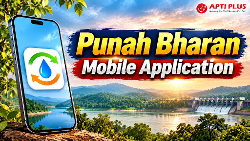
The Union Minister of Jal Shakti launched the Punah Bharan Mobile Application to promote scientific groundwater recharge planning through Geospatial Technology.
What Is the Punah Bharan Mobile Application?
-
Objective: It aims to improve groundwater recharge planning by identifying scientifically suitable locations for Artificial Groundwater Recharge using geospatial datasets.
-
Developed By: The Bhaskaracharya National Institute for Space Applications and Geo-informatics (BISAG-N) developed it in collaboration with the National Water Mission (NWM) under the Ministry of Jal Shakti.
Features
-
Geographical Assessment: It identifies potential artificial recharge zones within a radial distance of up to 3 km, helping users assess nearby locations.
-
Site-Specific Planning: It helps users explore suitable Artificial Recharge Structures (ARS) according to local geographical and hydrological conditions.
-
Village-Level Mapping: Its web portal provides village-level ARS Zonation Maps, GIS tools and thematic layers for decentralised groundwater planning.
-
Data Integration: It combines five major categories of geospatial information:
-
Rainfall: Identifies local precipitation patterns and potential water availability.
-
Groundwater Levels: Helps assess the existing groundwater situation.
-
Groundwater Yield: Supports assessment of groundwater availability and recharge potential.
-
Slope: Helps evaluate land gradients and infiltration suitability.
-
Drainage: Identifies natural drainage networks and potential water-conservation locations.
How Does Geospatial Technology Improve Groundwater Recharge Planning?
|
What Is BISAG-N?
BISAG-N is an autonomous scientific society registered under the Societies Registration Act, 1860, under the Ministry of Electronics and Information Technology (MeitY).
-
Location: Gandhinagar, Gujarat.
-
Objective: It promotes research and development, technology management, national and international cooperation, capacity building and technology transfer in geospatial technology.
-
Three Major Domains:
-
Satellite Communication: Uses satellite-based communication systems for various applications.
-
Geo-informatics: Develops GIS-based information systems and spatial decision-support tools.
-
Geo-spatial Technology: Provides mapping, spatial analysis and technology-based solutions.
-
GIS Applications: It provides specialised solutions for implementing map-based Geographic Information Systems (GIS) across governance and development sectors.
What Are the Major Challenges in Groundwater Recharge Management?
Groundwater Overexploitation
Unsustainable Extraction: Excessive groundwater withdrawal for irrigation, industries and domestic consumption often exceeds natural aquifer replenishment.
-
Example: The Dynamic Ground Water Resources Assessment, 2024 by the Central Ground Water Board (CGWB) assesses groundwater extraction and recharge across assessment units to identify over-exploited, critical and semi-critical areas.
Geographical and Geological Variations
Aquifer Heterogeneity: Recharge potential varies with soil permeability, geological formations, aquifer depth and local topography. A uniform recharge structure may not work across different regions.
-
Example: Hard-rock regions of peninsular India and alluvial aquifers of the Indo-Gangetic plains require different groundwater recharge approaches.
Weak Local-Level Implementation
Institutional Coordination: Groundwater management requires coordination among Gram Panchayats, state groundwater departments, watershed authorities and local communities.
Data and Technology Gaps
Ground-Level Validation: Geospatial maps provide potential recharge locations, but actual implementation requires field surveys, geological verification and water-quality assessment.
-
Example: Inaccurate groundwater records and inadequate monitoring can lead to unsuitable recharge structures and ineffective investments.
What Measures Can Strengthen Scientific Groundwater Management?
Integrate Technology with Local Planning
GIS-Based Planning: Integrate Punah Bharan outputs with district groundwater plans, watershed development plans and Gram Panchayat Development Plans.
-
Example: PM Gati Shakti National Master Plan demonstrates how geospatial platforms can integrate multiple datasets for coordinated infrastructure planning.
Promote Community-Based Groundwater Management
Participatory Water Budgeting: Encourage Gram Panchayats to prepare village-level water budgets covering rainfall, groundwater extraction, recharge and seasonal demand.
-
Example: Atal Bhujal Yojana promotes community-led groundwater management through Water Security Plans and participatory groundwater monitoring.
Strengthen Artificial Recharge Infrastructure
Site-Specific Interventions: Select suitable recharge structures based on geological and hydrological conditions, including percolation tanks, recharge shafts, check dams and recharge wells.
-
Example: Jal Shakti Abhiyan: Catch the Rain promotes rainwater harvesting and water conservation through localised interventions.
Establish Continuous Monitoring
Performance Assessment: Monitor groundwater-level changes before and after recharge interventions to assess actual outcomes rather than measuring success only through infrastructure created.
-
Example: National Aquifer Mapping and Management Programme (NAQUIM) of CGWB supports aquifer-level assessment and groundwater management planning.
Conclusion
The Punah Bharan Application advances data-driven, decentralised groundwater management. Success requires combining geospatial data with field verification, community involvement, and sustainable extraction.
Source: DD NEWS
|
PRACTICE QUESTION Q. With reference to the Punah Bharan Mobile Application, consider the following statements:
Which of the statements given above is/are correct? (a) 1 and 2 only (b) 2 and 3 only (c) 1 and 3 only (d) 1, 2 and 3 Answer: (d) 1, 2 and 3 Explanation: Statement 1 is correct: The Punah Bharan Mobile Application was launched by the Union Minister of Jal Shakti in October 2026. It was developed by the Bhaskaracharya National Institute for Space Applications and Geo-informatics (BISAG-N) in collaboration with the National Water Mission (NWM) under the Department of Water Resources, River Development & Ganga Rejuvenation. Statement 2 is correct: The application allows users to locate potential artificial recharge zones within a radial distance of up to 3 km from their current location, enabling targeted, village-level water conservation planning. Statement 3 is correct: To map out these zones and recommend precise water structures (like check dams or recharge shafts), the platform integrates multiple geospatial datasets, including rainfall, groundwater levels, groundwater yield, land slope, and drainage networks. |