Why In News?
The United Nations General Assembly adopted the first multilateral UN Declaration on Sea Level Rise.
What Causes Sea Level Rise?
Thermal Expansion: Ocean water expands as it absorbs over 90% of excess anthropogenic heat accumulated in the Earth's climate system, contributing to roughly one-third of observed global sea level rise.
Melting Glaciers: Accelerated ice mass loss from non-polar mountain glaciers worldwide steadily adds freshwater into ocean basins.
Ice-Sheet Loss: Rapid melting and dynamic calving of the colossal Greenland and Antarctic ice sheets, significantly outpacing historical rates of accumulation.
Global Warming: Atmospheric concentration of greenhouse gases driving global mean surface temperatures beyond 1.1°C to 1.2°C above pre-industrial baselines.
Ocean Warming: Elevated sea surface temperatures (SST) disrupting thermohaline circulation, driving oceanic stratification, and intensifying regional sea surface anomalies.
What is the UN Sea Level Rise Declaration?
Recognition of Sea Level Rise as an Existential Threat: Formally designates accelerating sea level rise as a systemic threat to global peace, human security, food systems, and civilizational survival.
Protection of Vulnerable Island States: Affirms special multilateral safeguards, financial mechanisms, and legal support for Small Island Developing States (SIDS) facing complete geographic submergence.
Statehood Concerns: Affirms that sea level rise-induced territorial inundation should not undermine recognized sovereign statehood, citizenship, or membership in international organizations under public international law.
Maritime Rights: Establishes principles to preserve baseline coordinates, territorial seas, contiguous zones, and Exclusive Economic Zones (EEZ) once established and deposited with the United Nations under UNCLOS (United Nations Convention on the Law of the Sea), preventing territorial forfeiture due to coastline retreat.
Climate Adaptation: Mandates scaled-up grant-based international adaptation funding and technical technology transfers to build coastal defenses and community resilience.
International Cooperation: Calls for cross-border cooperation on climate displacement, legal status of displaced populations, and global disaster risk reduction.
Why is India Vulnerable?
Long Coastline: India possesses an extensive coastline spanning 7,516.6 km, bordering nine coastal States, two Union Territories, and two island archipelagos.
Coastal Population: Over 170 million people reside across coastal districts, representing nearly 14% of India's population dependent on marine ecosystems.
Coastal Megacities: Economic growth engines such as Mumbai, Chennai, Kolkata, and Kochi are located in low-elevation coastal zones vulnerable to storm surges and tidal flooding.
Low-Lying Coastal Areas: Expansive river deltas across the eastern seaboard (Ganga-Brahmaputra-Meghna, Mahanadi, Godavari, Krishna, and Cauvery) lie barely 1 to 5 meters above mean sea level.
Cyclones and Storm Surges: Increasing frequency of high-intensity severe cyclonic storms in the Bay of Bengal and Arabian Sea drives elevated storm surges that breach inland defenses.
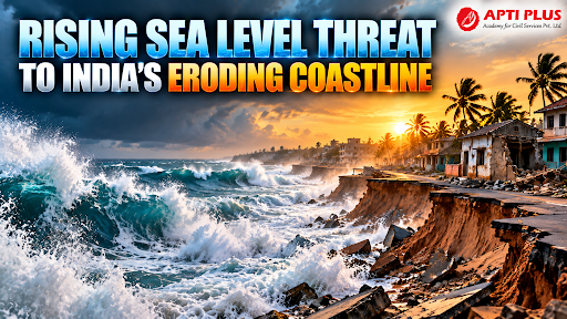
Coastal Erosion: Over 33.6% of the Indian mainland coastline underwent active erosion between 1990 and 2018, with the eastern coast exhibiting severe land recession.
Saltwater Intrusion: Rising sea heads force marine water into coastal aquifers and river estuaries, contaminating freshwater tables.
|
West Coast vs East Coast of India
|
What are the Impacts on India?
Loss of Coastal Land: According to the National Centre for Coastal Research (NCCR), 33.6% of India’s mainland coastline underwent active erosion between 1990 and 2018.
-
The most critical erosion occurs in West Bengal (60.5% eroding), Puducherry (56.2%), and Kerala (46.4%). Between 1990 and 2016 alone, India lost approximately 234.25 sq km of coastal land to sea erosion.
Damage to Infrastructure: According to projections synthesized by the IPCC Assessment Reports, up to 12 major coastal Indian cities—including Mumbai, Chennai, Kochi, and Visakhapatnam—could see sea levels rise between 0.5 to 1 metre by 2100, putting critical facilities like port terminals, refineries, and coastal expressways at regular risk of submersion and corrosion.
Threat to Fisheries: India is the world’s third-largest fish producer, supporting roughly 4 million marine fishers and allied workers across 3,477 coastal villages.
-
Coastal erosion, coupled with ocean warming in the Arabian Sea and Bay of Bengal, has degraded nearshore nursery areas and reduced catch per unit effort (CPUE), resulting in declining landed value and boat-parking space loss in key hubs.
Agricultural Salinity: In low-lying deltas, recurrent storm surges and tidal breaches have rendered vast areas unproductive.
-
Following cyclones like Amphan and Yaas, over 200,000 hectares of cropland in West Bengal and Odisha suffered prolonged soil salinisation, where soil electrical conductivity elevated to levels that shut down double-cropping (kharif paddy) for 2 to 3 consecutive years.
Groundwater Salinisation: Central Ground Water Board (CGWB) monitoring shows sea-level rise and over-extraction have pushed saltwater-freshwater interfaces 2 to 10 km inland in deep aquifers along coastal Tamil Nadu (Minjur/Chennai belt), Gujarat (Saurashtra coast), and the Krishna-Godavari delta, raising Total Dissolved Solids (TDS) well past the 1,000 mg/L safe drinking limit.
Coastal Displacement: More than 170 million people inhabit India’s coastal districts. In Kendrapara district (Odisha), sea erosion fully submerged 5 of the 7 historic hamlets of the Satabhaya Gram Panchayat, forcing the relocation of 571 households to India’s first designated resettlement site at Bagapatia.
-
In the West Bengal Sundarbans, erosion has shrunk Ghoramara Island from 26 sq km to under 4 sq km, displacing over 7,000 residents to Sagar Island and the mainland.
Biodiversity Loss: Critical ecological barriers face severe degradation. At the Gahirmatha and Rushikulya mass-nesting beaches (arribadas) in Odisha, accelerated wave erosion has reduced beach width by up to 40%, directly threatening millions of Olive Ridley sea turtle eggs.
-
Studies warn that without inland expansion zones, up to 80% of Sundarbans mangrove coverage could be drowned by 2100 under high sea-level rise scenarios.
Economic Losses: Annual coastal flood damages in India are projected to surge from $2.4 billion in 2010 to upwards of $75 billion annually by 2050 under unmitigated warming.
-
In Mumbai alone, high-tide extreme flooding combined with a 0.5-metre sea rise risks inflicting more than $50 billion in direct real estate and infrastructure losses by mid-century.
What Measures Can India Adopt?
Coastal Zone Management (CRZ): Strictly enforce the Coastal Regulation Zone (CRZ) Notification, 2019 to regulate unsustainable real estate construction, sand mining, and industrial discharge in sensitive No Development Zones (NDZ).
Mangrove Restoration (Nature-Based Solutions): Scale up blue carbon ecosystems and bio-shield plantations to naturally attenuate wave energy and dampen cyclonic storm surges.
-
Example: MISHTI (Mangrove Initiative for Shoreline Habitats & Tangible Incomes), restoring mangrove cover across 540 sq km of coastline through convergence with CAMPA and MGNREGS.
Engineered Coastal Protection: Build geo-synthetic tubes, submerged offshore breakwaters, and groynes rather than hard vertical concrete seawalls that exacerbate downdrift erosion.
-
Example: Puducherry Beach Restoration Project, deploying a submerged offshore reef and sand nourishment to restore eroded urban coastlines naturally.
Climate-Resilient Infrastructure: Elevate plinth levels of coastal roads, install salinity-resistant building materials, and construct cyclone shelters under the National Cyclone Risk Mitigation Project (NCRMP).
Early-Warning Systems: Deploy real-time storm surge prediction models, wave rider buoys, and ocean observation networks.
-
Example: INCOIS Storm Surge Early Warning System, delivering real-time ocean hazard advisories to coastal disaster management authorities.
Managed Retreat & Relocation: Plan proactive inland relocation frameworks for chronically inundated coastal villages rather than reactive post-disaster evacuation.
-
Example: Odisha Satabhaya Resettlement Model, successfully relocating coastal communities eroded by sea ingress in Kendrapara district to an inland rehabilitation colony.
Coastal Erosion Mapping: Monitor shoreline changes using high-resolution satellite remote sensing and LiDAR surveys to designate scientific hazard lines.
-
Example: National Centre for Coastal Research (NCCR) Shoreline Change Atlas, mapping three decades of erosion trends along India's entire coast.
Climate Adaptation Finance: Mobilize dedicated resources via the National Adaptation Fund for Climate Change (NAFCC) and international climate funds to support vulnerable coastal fisherfolk.
Conclusion
Safeguarding India’s eroding coastline against rising seas demands an integrated strategy that combines nature-based bio-shields, scientific shoreline regulation, and stable maritime baseline protections under international law.
Source: INDIANEXPRESS
|
PRACTICE QUESTION Q1. With reference to the impacts of sea level rise and coastal processes in India, consider the following statements: 1. Thermal expansion of ocean water and the mass loss of ice sheets are the two primary drivers of global mean sea level rise. 2. According to the National Centre for Coastal Research (NCCR), more than fifty percent of the Indian mainland coastline is undergoing active coastal accretion. 3. Under UNCLOS, fixed baseline coordinates deposited by coastal states remain permanently preserved regardless of any subsequent physical coastline retreat. Which of the statements given above is/are correct? (a) 1 only (b) 1 and 2 only (c) 2 and 3 only (d) 1, 2 and 3 Answer: (a) Explanation: Statement 1 is correct: According to assessments by the Intergovernmental Panel on Climate Change (IPCC), the primary physical mechanisms driving global mean sea level rise are the thermal expansion of seawater as oceans absorb heat and the mass loss of land-based ice (glaciers and ice sheets in Greenland and Antarctica). Accurately accounting for these processes produces the greatest benefit for vulnerable coastal communities by allowing targeted investments in mitigation and resilience. Statement 2 is incorrect: Shoreline change analysis conducted by the National Centre for Coastal Research (NCCR) indicates that out of the Indian mainland coastline, approximately 33.6% is undergoing erosion, 39.6% is stable, and only 26.9% is accreting (growing). Because resource allocation yields the highest welfare when directed to areas of severe deprivation, misidentifying the coast as mostly accreting would catastrophically divert attention away from erosion-impacted coastal settlements. Statement 3 is incorrect: Under the text of the United Nations Convention on the Law of the Sea (UNCLOS), normal baselines are generally treated as ambulatory (shifting along with the low-water line as the physical coastline retreats). While climate-vulnerable states, the International Law Association (ILA), and the International Law Commission (ILC) advocate for fixed baselines to secure legal stability and preserve maritime resources for human flourishing, UNCLOS itself contains no explicit treaty provision guaranteeing that baseline coordinates automatically remain permanently preserved against physical coastal regression. |



