Why In News?
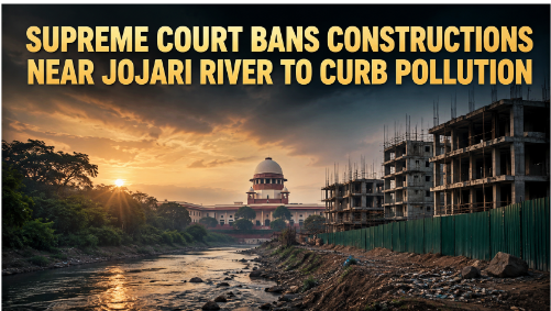
The Supreme Court banned all construction within 100 meters of the Jojari River's edge to protect its ecosystem from severe industrial pollution.
About Jojari River
It is a 83-kilometre-long seasonal ephemeral river flowing through the arid Marwar region across Nagaur, Jodhpur, and Balotra districts in Western Rajasthan.
-
An ephemeral river is a natural water channel that flows only briefly during or immediately after heavy rain.
River System & Hydrology: Originates near Pondlu village in Nagaur district and flows southwest to merge with the Luni River near Balotra.
-
It is the only major right-bank tributary of the Luni river system that does not originate in the Aravalli Range.
Urban and Industrial Influence: Traverses the dense industrial clusters of Jodhpur (Basni, Sangaria, Mandore) and Pali, where rapid urbanization has converted the natural riverbed into an open industrial storm drain.
Pollution Concerns: Discharges of toxic industrial effluents have turned the river water into an acidic, sludge-heavy stream with Chemical Oxygen Demand (COD) exceeding 300 mg/L and Total Dissolved Solids (TDS) exceeding 2,500 mg/L.
Ecological Importance: Primary drainage and groundwater recharge lifeline for local ecosystems, grazing pastures (orans), and surrounding pastoralist communities in the Thar desert fringe.

Highlights of the Supreme Court Judgment
Interim 100-Metre Buffer Zone: Prohibits all permanent and commercial construction within 100 metres of the river's edge.
500-Metre Restriction on Polluting Units: Bars hazardous chemical, dyeing, and polluting industries within 500 metres on either side of the existing flood line.
Integrated Coordination Group Mandate: Directed the Chief Secretary of Rajasthan to execute a comprehensive 20-point river restoration action plan covering the Jojari, Bandi, and Luni river basins.
Scientific High Flood Line Demarcation: Mandated the Central Water Commission (CWC) and the State Irrigation Department to determine the river's ecological boundaries and floodplains scientifically.
What is the High Flood Line (HFL)?
|
What are the Major Sources of Pollution?
Industrial Effluents: Over 1,000 textile printing, fabric bleaching, and dyeing units discharge millions of litres of untreated toxic effluents containing carcinogenic azo dyes.
Bypass of Common Effluent Treatment Plants (CETPs): Industrial units routinely bypass overloaded CETPs in Sangaria and Basni, routing toxic discharges through illegal clandestine pipelines directly into the riverbed.
Chemical & Heavy Metal Discharge: Steel re-rolling mills and pickling units release hazardous heavy metals, including Chromium, Lead, Cadmium, and Arsenic.
Untreated Municipal Sewage: Over 55 Million Litres per Day (MLD) of untreated domestic sewage from Jodhpur city flows directly into the river due to inadequate Sewage Treatment Plant (STP) capacity.
Solid Waste & Sludge Dumping: Unregulated dumping of municipal garbage, construction debris, and hazardous industrial sludge on the riverbed obstructs natural water flows.
Encroachment of Riverbanks: Unchecked real estate development and commercial warehousing shrink the active floodplain, intensifying flood risks and destroying riparian vegetation.
Way Forward
Execute Scientific Drone & Satellite Floodplain Mapping: Use high-resolution GIS and drone surveys to demarcate the High Flood Line (HFL) and mark the 100-metre no-construction buffer permanently.
Enforce Mandatory Zero Liquid Discharge (ZLD): Upgrade all industrial CETPs in Jodhpur, Pali, and Balotra to 100% Zero Liquid Discharge standards with closed-loop water recycling.
Deploy 24x7 Online Continuous Effluent Monitoring Systems (OCEMS): Install automated digital sensors at every industrial discharge outlet, streaming real-time BOD/COD data directly to CPCB servers.
Expand Municipal Sewage Interception and Treatment: Fast-track construction of modern STPs to ensure zero untreated domestic sewage enters the Jojari river system.
Create Dedicated Riparian Ecological Buffer Corridors: Plant native deep-root vegetation (Prosopis cineraria, Acacia nilotica) along the 100-metre riverbanks to filter runoff naturally.
Long-Term Relocation of Hazardous Industrial Clusters: Formulate a phased master plan to shift highly polluting dyeing and chemical units away from sensitive riverbank corridors.
Institutionalize River Basin Community Governance: Involve local Gram Panchayats, farming cooperatives, and civil society oversight committees in regular river monitoring and protection.
Conclusion
The Supreme Court’s interim ban protects the Jojari riverine ecosystem and reinforces the constitutional mandate under Article 21 that economic industrial growth cannot occur at the expense of ecological survival.
Source: THEHINDU
|
PRACTICE QUESTION Q. With reference to the drainage system of Rajasthan, consider the following statements regarding the Jojari River: 1. It is the only right-bank tributary of the Luni river system. 2. It originates in the Aravalli Range near Ajmer. 3. It merges with the Luni River in Balotra district. Which of the statements given above are correct? (a) 1 and 2 only (b) 1 and 3 only (c) 2 and 3 only (d) 1, 2, and 3 Answer: (b) 1 and 3 only Explanation: Statement 1 is correct: The Jojari River is uniquely known as the only right-bank tributary of the Luni river system. All other major tributaries feed into the Luni River from its left bank. Statement 2 is incorrect: Unlike most other tributaries of the Luni River, the Jojari does not originate from the Aravalli Range. Instead, it originates in the plains near Pandalu village in the Nagaur district of Rajasthan. Statement 3 is correct: The Jojari River flows through the Jodhpur district and merges with the Luni River near Khejadli/Samdari in the Balotra district (formerly a part of the Barmer district). |



