Why In News?
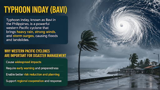
Typhoon Inday (Bavi), a Category 5-equivalent super typhoon, recently devastated the Western Pacific, prompting urgent global evaluations of disaster resilience and advanced forecasting mechanisms.
What is Typhoon Inday (Bavi)?
Typhoon Inday (Bavi) reached Category 5-equivalent intensity with peak 1-minute sustained winds of 285 km/h and a central pressure of 901 hPa.
The storm affected over 514,700 individuals and caused at least 17 fatalities in the Philippines due to severe landslides and flooding, as reported by the National Disaster Risk Reduction and Management Council.
Measuring nearly 1,000 km in width, the storm battered U.S. Pacific territories, Japan’s Sakishima Islands, Taiwan, and mainland China, exposing global supply chain vulnerabilities.
What is a Typhoon?
A typhoon is a mature, rapidly rotating tropical cyclone characterized by a low-pressure center, closed low-level atmospheric circulation, intense winds, and a spiral arrangement of thunderstorms.
The term "typhoon" applies exclusively to the Northwestern Pacific Ocean basin. Identical phenomena are termed "hurricanes" in the North Atlantic and "cyclones" in the Indian Ocean.

How Do Typhoons Form?
Warm Ocean Waters: Cyclogenesis requires Sea Surface Temperatures (SSTs) above 26.5°C. Typhoon Bavi developed over exceptionally warm waters measuring 29°C to 30°C.
High Atmospheric Moisture: High relative humidity in the middle atmosphere supplies latent heat, enabling the vertical stacking of the storm's convective wall.
Low Vertical Wind Shear: Minimal vertical wind shear—recorded at a low 5 to 10 knots during Bavi's formation—ensures the storm's core structure remains intact.
Coriolis Force-Induced Rotation: The Coriolis force deflects air currents to create the cyclone's spin, occurring at least 5 degrees north or south of the equator.
Sustained Thunderstorm Activity: Continuous cycles of evaporation and condensation release massive latent heat, intensifying the Central Dense Overcast (CDO) and forming a calm eye.
Why is the Northwest Pacific the Most Active Cyclone Basin?
Extensive Warm Ocean Surface: The vast, uninterrupted expanse of warm water provides a continuous energy supply for frequent cyclogenesis.
High Moisture Availability: Prevailing trade winds push warm, moist surface waters toward the western margins, creating an ideal thermodynamic environment.
Favorable Atmospheric Circulation: Unlike eastern margins stabilized by cold currents, western margins lack inhibiting cold water upwelling, keeping the lower atmosphere unstable.
Frequent Tropical Disturbances: The Intertropical Convergence Zone (ITCZ) spawns numerous low-pressure systems that rapidly organize into tropical depressions.
Measures to Improve Cyclone Resilience
Strengthen Forecasting: Integrate generative AI tools like Marchuk to operate in a compressed latent space for probabilistic sub-seasonal weather forecasts.
Expand Warning Networks: Scale up Community-Based Disaster Risk Reduction and Management (CBDRRM) programs to empower localized incident command systems.
Build Resilient Infrastructure: Execute the "Build Back Better" mandate by enforcing National Building Codes to retrofit critical infrastructure.
Improve Coastal Management: Prioritize Nature-Based Solutions to restore degraded wetlands and dissipate the kinetic energy of storm surges.
Enhance International Cooperation: Align national protocols with treaties like the ASEAN Agreement on Disaster Management and Emergency Response (AADMER).
Conclusion
To neutralize the escalating destructiveness of Western Pacific typhoons like Bavi, nations must synergize AI-driven sub-seasonal forecasting, ecosystem-based coastal management, and highly localized early warning protocols.
Source: NEWSINFO
|
PRACTICE QUESTION Q. Consider the following statements regarding the formation and characteristics of Tropical Cyclones: 1. They require sea surface temperatures (SSTs) consistently above 26.5°C to fuel explosive intensification. 2. They frequently form directly over the equator due to the maximum concentration of solar insolation. 3. Minimal vertical wind shear is an absolute prerequisite to maintain their deep convective core. Which of the statements given above is/are correct? A) 1 and 2 only B) 1 and 3 only C) 2 and 3 only D) 1, 2, and 3 Answer: B Explanation: Statement 1 is correct: Tropical cyclones derive their primary energy from the latent heat released during the condensation of moist air. This process requires ocean waters with a minimum Sea Surface Temperature (SST) of about 26.5°C to consistently fuel explosive intensification. Statement 2 is incorrect: They almost never form directly over or within 5° of the equator. The Coriolis force—which is required to impart the necessary rotation and spin to the developing weather system—is zero at the equator. Statement 3 is correct: Minimal vertical wind shear is an absolute prerequisite. High wind shear can displace moisture and heat from a storm's center, effectively tilting the convective core, altering the symmetry of the vortex, and tearing the storm apart before it can mature. |



