Why In News?
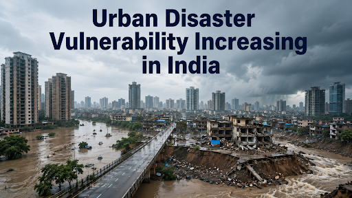
Unchecked construction on natural wetlands, outdated drainage networks, and intense, climate-driven rainfall events converge to heighten the disaster vulnerability of Indian cities.
What is Urban Disaster Vulnerability?
Urban disaster risk emerges from the interaction of hazard + exposure + vulnerability; rapid urbanisation increases exposure while weak planning increases vulnerability.
India has over 50 urban agglomerations with populations above 1 million, concentrating people, infrastructure and economic assets in hazard-prone spaces.

What are the Major Urban Disasters?
Urban Floods
India has about 40 million hectares flood-prone, while rapid concretisation reduces infiltration and overwhelms drainage systems. (Source: NITI Aayog)
Heatwaves
Urban Heat Island effects can raise city-centre temperatures by 3–4°C above surrounding areas, intensifying heat stress and mortality risks.
Cyclones
Coastal cities face a compound risk of high winds + storm surge + extreme rainfall, where dense infrastructure increases potential economic losses.
Earthquakes
Dense construction magnifies seismic exposure, particularly where buildings do not comply with earthquake-resistant standards; structural retrofitting therefore becomes a risk-reduction measure.
Landslides
Hill cities face growing exposure from construction on unstable slopes, road cutting and extreme rainfall; Himachal Pradesh recorded about $1 billion in extreme-weather losses in the last three years. (Source: World Bank)
Urban Fires
Dense informal settlements, narrow access roads and inadequate fire infrastructure increase the probability of rapid fire spread and delayed emergency response.
Air-Pollution Emergencies
Air pollution creates a recurring urban health emergency; India recorded approximately 1.67 million pollution-attributable deaths in 2019. (Source: Lancet)
Building Collapse
Ageing structures, weak enforcement and construction on unsuitable land convert localised hazards into mass-casualty events, particularly in rapidly expanding cities. (Source: NDMA)
What are the Social Impacts?
Unequal Burden
Urban disasters are regressive: poor households often live in hazard-prone locations and have fewer savings, insurance and recovery options; Mumbai’s 2005 floods caused 60% higher losses for poor households than richer neighbours. (Source: World Bank).
Informal Settlements
Unsafe housing, weak drainage and limited basic services amplify disaster exposure; globally, 1 billion slum residents face heightened climate risk. (Source: World Bank).
Displacement & Homelessness
Floods, landslides and cyclones can destroy insecure housing and displace vulnerable communities, converting a temporary hazard into long-term livelihood and housing insecurity.
Livelihood Shock
Daily-wage workers bear immediate income losses because work cannot shift online; globally, floods can directly affect up to 10% of city jobs. (Source: World Bank)
Health Inequality
Heat increases heatstroke and cardiovascular stress, while floods increase waterborne-disease risks; Ahmedabad's 2010 heatwave produced at least 30% excess mortality.
Gendered Vulnerability
Women, children, elderly persons and persons with disabilities often have lower mobility, weaker access to assets and greater care burdens during evacuation and recovery.
What are the Economic Impacts?
Economic Loss
The December 2015 Chennai floods caused about $2.2 billion in economic losses, demonstrating how drainage failure and extreme rainfall can disrupt an economically important metropolitan region. (Source: World Bank)
Infrastructure Loss
India's urban growth is increasing exposure: over two-thirds of urban dwellers could face pluvial-flood risk, with potential losses of $5 billion annually by 2030. (Source: World Bank)
Transport Disruption
More than one-fourth of India's urban roads are directly exposed to flooding; inundation of only 10–20% of roads can disrupt over half of urban transport systems in some cities. (Source: World Bank)
Productivity Loss
India could face 34 million job-equivalent losses from heat-stress-related productivity decline by 2030, disproportionately affecting outdoor and informal workers. (Source: ILO)
Business Continuity
Flooded roads, power failures and disrupted supply chains create cascading losses beyond the directly affected zone, reducing urban productivity and investment confidence.
Fiscal Pressure
Repeated disasters shift public expenditure from development to reconstruction; the World Bank estimates $10.95 trillion may be required over three decades for climate-resilient urban infrastructure and services in India. (Source: World Bank)
Disaster Management Framework
|
What are India's Major Urban Resilience Initiatives?
Disaster Management Framework
NDMA's hazard-specific guidelines cover floods, heatwaves and other urban risks, shifting disaster management from post-disaster relief towards risk reduction and preparedness.
AMRUT
AMRUT supports storm-water drainage, water supply and urban infrastructure; its resilience value lies in reducing infrastructure exposure to flooding and water stress.
Smart Cities Mission
100 cities were selected under the Smart Cities Mission, with Integrated Command and Control Centres providing real-time monitoring of urban services and emergencies.
National Mission on Sustainable Habitat
NMSH integrates energy efficiency, sustainable mobility, water management, waste management and climate-resilient urban planning, linking urban development with climate adaptation.
Heat Action Plans
Ahmedabad's Heat Action Plan pioneered an early-warning and public-health model; the World Bank identifies it as a replicable example involving alerts, healthcare preparedness, cool roofs and protection of outdoor workers.
Climate-Resilient Urban Planning
The World Bank estimates India's urban population could rise from 480 million in 2020 to 951 million by 2050, making climate-resilient planning of new infrastructure more cost-effective than later retrofitting.
Challenges in Urban Governance
Weak Municipal Finances
ULBs lack fiscal autonomy; CAG found government transfers constituted 88.78% of ULB funds in Odisha (2015–20), limiting independent resilience spending.
Fragmented Governance
Urban flooding cuts across drainage, water, roads and disaster management, yet fragmented departmental control weakens unified response; NDMA recommends city-level integrated flood-management plans within master planning.
Risk-Blind Urban Planning
Rapid built-up expansion reduces storm-water absorption; the World Bank estimates over two-thirds of India's urban population could face pluvial-flood risk, with potential losses of $5 billion annually by 2030. (Source: World Bank)
Infrastructure–Climate Mismatch
Legacy drains designed for historical rainfall cannot absorb increasingly intense precipitation, making conventional grey infrastructure insufficient without blue-green infrastructure.
Loss of Natural Buffers
Encroaching on wetlands and lakes destroys the natural ability of cities to store floodwater, leading to urban flooding during heavy rains.
Climate-Data Deficit
Without hyperlocal rainfall, drainage and flood-risk mapping, municipal investments remain reactive rather than risk-informed; flood-risk assessment and city-scale planning are identified as core elements of resilient urban management.
Informal Settlements
Informal settlements occupy low-lying or drainage-sensitive land, while insecure tenure discourages household-level resilience investment, making the urban poor disproportionately exposed.
Early-Warning Last-Mile Gap
India already operates SACHET, providing geo-targeted, multilingual, near-real-time alerts; the remaining challenge is ensuring ward-level dissemination translates into timely evacuation.

Way Forward
Make Risk Mapping Statutory
Mandate flood-hazard maps, drainage catchments and climate projections as inputs to every city master plan, following NDMA's integrated flood-planning approach.
Finance Resilience at Municipal Level
Use Finance Commission transfers and municipal own-source revenues for resilience; the 16th Finance Commission has collected ULB-level fiscal data through CityFinance, creating a stronger evidence base for urban fiscal reform.
Adopt Sponge-City Infrastructure
Chennai's sponge parks manage up to 90% of incoming runoff and store 30+ million litres, demonstrating that wetlands and public spaces can function as flood infrastructure. (Source: NITI Aayog)
Upgrade Early-Warning Systems
Scale SACHET's geo-targeted, multilingual Common Alerting Protocol (CAP) architecture to ward-level evacuation protocols, linking alerts with shelters, traffic control and emergency responders.
Build for Future Rainfall
The World Bank recommends resilient drainage, green spaces, flood-resilient transport and stronger early-warning systems; India should design infrastructure against future climate extremes rather than historical averages.
Use Bengaluru as a Model
The $426-million Karnataka Water Security & Resilience Programme combines lake restoration, advanced flood modelling, STPs and early-warning systems, offering an integrated city-level model.
Strengthen Municipal Capacity
CAG audits show that weak own-revenue mobilisation and incomplete devolution constrain ULB capacity; property-tax reform, timely State Finance Commission transfers and professional municipal cadres should therefore accompany resilience funding.
Integrate Nature + Engineering
Amaravati's planned flood-management system combines 30% open space, retention reservoirs, flood protection and early-warning systems, highlighting a hybrid grey-green approach.

Conclusion
India's cities can only become disaster-resilient when planning treats floods, heat, and extreme rainfall as recurring risks to be designed for, not emergencies to be reacted to.
Source: FUNDSFORNGOS
|
PRACTICE QUESTION Q. "Urban flooding in India is a man-made disaster rather than a natural calamity." Examine this statement with recent examples. 150 words |