Why In News?
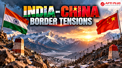
The Ministry of External Affairs (MEA) confirmed that border peace along the Line of Actual Control (LAC) gets periodically disturbed when People's Liberation Army (PLA) forces diverge from established patrolling patterns.
What Is The Line Of Actual Control And How Are Border Patrol Patterns Established?
Notional Demarcation Line: The Line of Actual Control (LAC) is a delineated, non-demarcated boundary that separates Indian-controlled territory from Chinese-controlled territory across a 3,488-km frontier.
-
It is divided into three operational sectors: the Western Sector (Ladakh and Aksai Chin), the Middle Sector (Himachal Pradesh and Uttarakhand), and the Eastern Sector (Arunachal Pradesh and Sikkim, aligning with the McMahon Line).

Historical Origins and Legal Status: The concept originated in a 1959 letter from Chinese Premier Zhou Enlai to Prime Minister Jawaharlal Nehru.
-
It gained formal legal recognition under the Border Peace and Tranquility Agreement, 1993, which mandated maintaining peace while explicitly preserving each side's legal position on the broader boundary dispute.
Establishment of Patrol Points: In the 1970s, India's China Study Group (CSG) designated over 65 Patrol Points (PPs) in Eastern Ladakh (stretching from Karakoram Pass to Chumar) and specific limits of patrolling in the Eastern Sector to systematically monitor frontiers without maintaining permanent physical garrisons on every peak.
Patrol Mechanics: Patrol routes and frequency are determined by local terrain and strategic necessity. Border-guarding troops—primarily the Indo-Tibetan Border Police (ITBP) across 197 operational Border Out Posts (BOPs)—conduct periodic patrols up to these designated limits of patrolling to physically assert territorial sovereignty.
Overlapping Perceptions: Because the LAC has never been mutually delineated or mapped on the ground, both militaries execute overlapping patrols according to their respective areas of differing perceptions, leading to periodic non-lethal face-offs.
Why Do Chinese Troops Deviate From Established Patrolling Patterns Along The Border?
Asserting Unilateral Territorial Claims: People's Liberation Army (PLA) forces diverge from customary patrol paths to press unilateral claims into areas of differing perceptions, such as the Taksing sector in Upper Subansiri district of Arunachal Pradesh and the Depsang Plains.
Grey-Zone and Salami-Slicing Strategy: Tactical deviations serve as incremental, sub-conventional incursions to alter the status quo on the ground without triggering a full-scale conventional military conflict.
Dual-Use Border Civil Settlements: China leverages its 2021 Land Border Law and Military-Civil Fusion (MCF) framework to build over 600 Xiaokang border villages (such as Zhuangnan, Majiduncun, and Kuiqiongmen) along the LAC, integrating civilian settlements with military logistics to solidify permanent physical presence.
Logistical Superiority and Strategic Pressure: High-altitude transport corridors—including the Xinjiang-Tibet Railway and the G695 Highway across Aksai Chin—enable the PLA Western Theater Command to rapidly mobilize troops and create friction points to exert pressure against India's border infrastructure development.
What Challenges Hinder Border Peace Along The LAC?
Absence of Mutual LAC Delineation: The failure to exchange official maps depicting respective perceptions of the LAC (a process that collapsed in 2002–2003) leaves the boundary ambiguous, making routine patrols prone to confrontation.
Buffer Zones and Restricted Patrol Access: Post-crisis disengagement agreements (such as the October 2024 Depsang and Demchok pact) created temporary buffer zones and restricted patrolling guidelines. While mitigating immediate clashes, these arrangements create operational asymmetry by restricting physical access to traditional patrol points.
Dual-Track Reality and Permanent Militarization: Frontline troop pullbacks have not resulted in rear-echelon de-escalation. Both forces remain heavily deployed within supporting distance, replacing pre-2020 confidence-building protocols with a managed, highly militarized equilibrium.
Rugged Geography and Surveillance Bottlenecks: Severe Himalayan weather and extreme altitude restrict year-round physical surveillance across remote Border Out Posts (BOPs), complicating real-time tactical verification during sudden weather disruptions.
Way Forward
Institutional Diplomatic & Military Dialogues: Utilize multi-tiered communication platforms, including the Working Mechanism for Consultation and Coordination on India-China Border Affairs (WMCC), the Special Representatives Mechanism (SRM), and Corps Commander-Level Talks, to prevent miscalculations and enforce strict border management protocols.
Accelerated Border Infrastructure: Expand the India-China Border Roads (ICBR) project managed by the Border Roads Organisation (BRO)—including strategic tunnels like Sela and Atal—and develop border habitations via the Vibrant Villages Programme (VVP) to prevent demographic out-migration and ensure rapid military mobilization.
Force Modernization and High-Tech Surveillance: Upgrade ITBP capabilities by deploying dedicated drone platoons, counter-drone systems, and elite Shaurya commando platoons trained in specialized high-altitude mountain warfare.
Strategic Autonomy and Economic Resilience: Practice calibrated engagement by strengthening domestic manufacturing via the Production Linked Incentive (PLI) scheme and FDI screening to address asymmetric supply-chain dependencies, while deepening Indo-Pacific partnerships (e.g., Quad, foundational defense pacts like BECA and LEMOA) without compromising sovereign decision-making.
Conclusion
Sustained border peace along the Line of Actual Control requires combining continuous diplomatic crisis management with strategic military deterrence and resilient frontier infrastructure.
Source: ECONOMICTIMES
|
PRACTICE QUESTION Q. Consider the following statements regarding the Line of Actual Control (LAC) and border management mechanisms between India and China:
Which of the statements given above is/are correct? (a) 1 and 2 only (b) 2 only (c) 2 and 3 only (d) 1, 2, and 3 Answer: (b) Explanation: Statement 1 is incorrect: The Line of Actual Control (LAC) is a notionally delineated, non-demarcated line that has neither been jointly mapped on the ground nor legally ratified as an international boundary. Statement 2 is correct: The WMCC was established in 2012 as an institutional framework for consultation and coordination to maintain peace and tranquility along border areas. Statement 3 is incorrect: The Indo-Tibetan Border Police (ITBP) is a Central Armed Police Force (CAPF) under the administrative and operational control of the Ministry of Home Affairs (MHA), not the Ministry of Defence. |