Why In News?
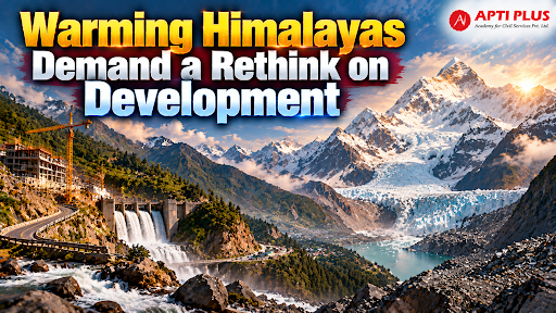
Permafrost thaw in the Hindu Kush Himalaya is destabilising mountain slopes, creating an urgent need to halt and overhaul high-altitude infrastructure like dams and tunnels across the region.
What Is The Hindu Kush Himalaya (HKH) Region?
The Hindu Kush Himalaya (HKH) spans approximately 3,500 kilometers across 8 regional member countries—Afghanistan, Bangladesh, Bhutan, China, India, Myanmar, Nepal, and Pakistan—holding the largest ice mass outside the polar regions.
Water Security: The HKH directly supports 240 million mountain inhabitants and supplies freshwater baseflow to 1.65 billion to 2 billion downstream people across major Asian river basins including the Indus, Ganges, and Brahmaputra.

Accelerated Warming: High Mountain Asia experiences warming at 0.3°C per decade—nearly 1.5 to 2 times faster than the global average—due to the Himalayan amplification effect and Elevation Dependent Warming (EDW).
Cryospheric Loss: Glacial ice loss rates across the HKH have doubled since 2000. Under a 1.5°C warming scenario, HKH glaciers will lose one-third of their ice volume by 2100, accelerating to a two-thirds loss under current emission trajectories. (Source: ICIMOD )
What Is The Climate And Development Dilemma In The Himalayas?
Geophysical Fragility & Seismic Activity: As young fold mountains growing at 10 mm per year with the Indian subcontinent subducting northwards at 5 cm per year, the Himalayas are naturally unstable and prone to frequent earthquakes and slope failures.
Climate Risk Multiplier: Between January 2022 and March 2025, extreme weather events occurred on 822 out of 1,186 days across 13 Himalayan states and UTs, resulting in 2,863 fatalities. (Source: CSE)

Extractivist Growth Paradigm: Central and state agencies treat mountain ecosystems as peripheral resource repositories, converting fragile topographies into capital circuits for heavy hydropower and timber extraction.
Tourist Footfall & Carrying Capacity Overload: Unregulated tourism, highlighted by 18,124,694 tourist arrivals in Himachal Pradesh in 2024 alone, severely strains municipal waste management, drains natural springs, and increases vehicular emissions that accelerate early snowmelt.
Application of Lowland Infrastructure Templates: Forcing uniform double-lane highways, heavy concrete structures, and deep excavation onto steep slopes violates mountain carrying capacity and destabilizes slope geometry.
Why Are Himalayan Slopes And Glacial Lakes Becoming Unstable?
Rapid Glacial Lake Expansion: Accelerating glacier retreat has created over 5,000 moraine-dammed glacial lakes across the Himalayas. In Uttarakhand, glacial lake surface area expanded by 8.1%, with 426 lakes exceeding 1,000 square meters. (Source: Ijrpr)
Clustering of Potentially Dangerous Glacial Lakes (PDGLs): Multi-criteria evaluations classify 25 glacial lakes in Uttarakhand as PDGLs (with 6 Category A lakes requiring immediate intervention). The Alaknanda Valley holds 9 PDGLs while the Dhauliganga Valley holds 6 PDGLs.(Source: Ijrpr)
High-Altitude Precipitation Phase Shift: Temperature spikes cause rainfall to replace snowfall at elevations of 4,000 to 5,000 meters, lowering surface ice albedo, delivering thermal energy directly to glaciers, and triggering permafrost thaw that releases steep rock walls.
Unscientific Hill Cutting & Road-Cut Failures: Over 70% of Himalayan roads are constructed by cutting into hills without proper slope stabilization. Geotechnical studies along National Highway 7 (Karnaprayag to Joshimath corridor) reveal that 81% of active landslides occurred within 100 meters of road cuts.
Hydropower Tunneling & Blasting Impacts: Underground blasting for run-of-the-river hydropower projects destabilizes fragile geology, triggers rockfalls, dries up local groundwater springs, and generates massive muck dumping along river courses.
What Are The Challenges In Himalayan Governance?
Superficial Environmental Approvals: Environmental Impact Assessments (EIAs) under the Environment (Protection) Act, 1986 are frequently treated as administrative formalities, failing to account for cumulative basin-wide hydrological loading or geological feasibility.
Fragmented Agency Operations: Disconnected governance between the Central Water Commission (CWC), National Disaster Management Authority (NDMA), state disaster bodies, and road building agencies prevents integrated risk management.
Outdated Road Engineering Guidelines: Highway construction relies on static Indian Roads Congress (IRC) "return-period" models that assume climate stationarity, failing to withstand cascading hazards like sediment flows and channel blockages.
Absence of Transboundary Risk Mechanisms: Disaster events frequently cross international borders—such as the 2023 South Lhonak GLOF in Sikkim impacting Bangladesh and the Langtang ice collapse in Nepal—yet transboundary early warning systems and real-time data exchange remain severely underdeveloped.
Way Forward To Restore Himalayan Ecology
River Basin & Watershed Governance: Transitioning from political-administrative boundaries to river basin management units using Multi-Hazard Susceptibility Zoning (MHSZ) to delineate development, controlled, and restricted zones.
GLOF Risk Mitigation: Implementing the Rs 150 crore National GLOF Risk Mitigation Programme (NGRMP) across Arunachal Pradesh, Himachal Pradesh, Sikkim, and Uttarakhand, deploying real-time telemetry, automated water-level sensors, and controlled lake drainage models at pilot sites like Vasundhara Lake in Chamoli.
Statutory Eco-Sensitive Buffer Enforcement: Enforcing ecological protection under the Environment (Protection) Act, 1986—such as the Bhagirathi Eco-Sensitive Zone (BESZ)—by capping visitor traffic (e.g., 150 daily pilgrims at Gaumukh) and prohibiting road construction within a 10 km buffer zone around sacred high-altitude sites.
Terrain-Responsive Green Infrastructure: Replacing aggressive hill cutting with single-lane formations featuring passing bays, elevated viaducts, bio-engineering slope stabilization (bamboo crib walls, hydroseeding), and implementing the Avay Shukla Committee and Ravi Chopra Committee recommendations to prohibit or strictly review major hydropower construction above 2,200 meters elevation.
Spring Rejuvenation & Indigenous Adaptation: Combining Geological Survey of India hydro-geological mapping with traditional knowledge—including Johad runoff ponds, Naula spring protection, Kuhl irrigation networks, and earthquake-resilient vernacular architecture—to restore drying mountain aquifers and build community resilience.
Conclusion
Sustaining the Himalayas requires an immediate shift from extractivist lowland growth models toward hazard-averse ecological planning, basin-level governance, and community-led adaptation to safeguard national water security and regional stability.
Source: THEHINDU
|
PRACTICE QUESTION Q. Discuss the concept of ecological carrying capacity and examine its relevance for regulating urban growth and infrastructure development in the fragile Himalayan ecosystem. (10 Marks, 150 Words) |